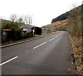
IMAGES TAKEN NEAR TO
Sunnyside Terrace, PORT TALBOT, SA13 3LY

Introduction

This page details the photographs taken nearby to Sunnyside Terrace, SA13 3LY by members of the Geograph project.

The Geograph project started in 2005 with the aim of publishing, organising and preserving representative images for every square kilometre of Great Britain, Ireland and the Isle of Man.

There are currently over 7.5m images from over14,400 individuals and you can help contribute to the project by visiting https://www.geograph.org.uk

Image Map


Images are licensed for reuse under creativecommons.org/licenses/by-sa/2.0
Notes
  • Clicking on the map will re-center to the selected point.
  • The higher the marker number, the further away the image location is from the centre of the postcode.

Image Listing (16 Images Found)

Images are licensed for reuse under creativecommons.org/licenses/by-sa/2.0
Image
Details
Distance
1
Sunnyside Terrace
Row of terraced houses at the lower end of the Corrwg valley.
Image: © Alan Hughes Taken: 23 Nov 2020
0.01 miles
2
Sunnyside Terrace, Cymmer
A typical sight in many, many Valleys towns and villages; a row of terraced houses overlooking the valley bottom and usually what was once the place of work, a mine or railway. Now these houses look out on walkers and mountain bikers.
Image: © Jeremy Bolwell Taken: 24 Jun 2011
0.01 miles
3
Avondale Terrace, Cymer
Image: © Nick Smith Taken: 13 Jan 2012
0.05 miles
4
Glyncorrwg Cycle Track
Hen reilfordd sy'n bellach yn drac seiclo a gysyllta Glyncorrwg a phentre Cymer. Former railway now a cycle track linking Glyncorrwg with Cymer (trans. confluence).
Image: © Alan Richards Taken: 7 Mar 2004
0.06 miles
5
The River Avan, Cymer
Image: © Nick Smith Taken: 13 Jan 2012
0.06 miles
6
Llwybr beicio i Gymer / Cycle path to Cymmer
Llwybr beicio yn mynd i gyfeiriad Cymer. Y rhes o dai yn y pellter yw Sunnyside Terrace. A cycle path heading towards Cymmer < cymer (trans. river confluence). The row of houses in the distance is Sunnyside Terrace.
Image: © Alan Richards Taken: 7 Mar 2004
0.06 miles
7
R.EVS Plastering and building
Colourful advertising by local graffiti artist, Nina Camplin. See: https://www.instagram.com/ninacamplin/reel/C96u4fGOHSA/
Image: © Alan Hughes Taken: 21 Aug 2024
0.13 miles
8
Twin peaks, Cymmer
Viewed from National Cycle Network route 885 between Cymmer and Croeserw.
Image: © Jaggery Taken: 18 Feb 2015
0.17 miles
9
Avondale Terrace beyond the houses, Cymmer
Viewed from the northern edge http://www.geograph.org.uk/photo/4355620 of the houses in Avondale Terrace. The next houses ahead, out of shot, are in Sunnyside Terrace.
Image: © Jaggery Taken: 18 Feb 2015
0.18 miles
10
View from the Health Centre car park, Cymmer
The river valley of the Afon Corrwg, a tributary of the Afon Afan. The roads are Avon Street (in the foreground) and Avondale Terrace.
Image: © Jaggery Taken: 18 Feb 2015
0.18 miles