1
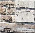
Ordnance Survey Cut Mark
This OS cut mark can be found on No64 Talbot Road. It marks a point 9.507m above mean sea level.
Image: © Adrian Dust
Taken: 6 May 2020
0.02 miles
2
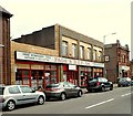
J.R. Motor Spares, Port Talbot
Business on the corner of Talbot Road and Talcennau Road.
Image: © Jaggery
Taken: 19 Apr 2012
0.04 miles
3
Port Talbot : Alleyway
An alley between Cambrian Place and Gower Street.
Image: © Lewis Clarke
Taken: 23 Jul 2017
0.06 miles
4
Port Talbot : Cambrian Place
Cambrian Place with a for sale sign outside one of the houses.
Image: © Lewis Clarke
Taken: 23 Jul 2017
0.07 miles
5
WGCADA Centre, Port Talbot
Located on Talbot Road, next door to the YMCA.
WGCADA (West Glamorgan Council on Alcohol and Drug Abuse Limited)
is a registered charity and limited company founded in 1979.
It aims to prevent, treat and reduce the harm caused by alcohol
and drugs to individuals, their families and the community.
Image: © Jaggery
Taken: 19 Apr 2012
0.08 miles
6
Kickstart Motorcycles shop, Port Talbot
Occupying the ground floor of Romilly House (built 1924), on the corner of Talbot Road and Broad Street.
Image: © Jaggery
Taken: 19 Apr 2012
0.08 miles
7
Talbot Court Nursing Home, Port Talbot
The independent care home, located on Talbot Road, has accommodation for 30 residents.
Image: © Jaggery
Taken: 19 Apr 2012
0.08 miles
8
Page's D.I.Y store, Port Talbot
Founded in 1918, the business is mainly a supplier to industry and tradesmen. The DIY enthusiast and ordinary customer are also welcome. On sale here are timber, ironmongery, tools and hardware. A key cutting service is available. Located on Talbot Road, next door to the YMCA. http://www.geograph.org.uk/photo/2906978
Image: © Jaggery
Taken: 19 Apr 2012
0.08 miles
9
YMCA, Port Talbot
The YMCA premises on Talbot Road include, on the left, the Port Talbot YMCA Foyer Project, offering accommodation for young people (aged 16-25). On the right is the YMCA Indulge cafe, a community cafe open to everyone.
Image: © Jaggery
Taken: 19 Apr 2012
0.08 miles
10
Ordnance Survey Cut Mark
This OS cut mark can be found on the SE face of Dyffryn Lower School. It marks a point 13.164m above mean sea level.
Image: © Adrian Dust
Taken: 6 May 2020
0.09 miles


