IMAGES TAKEN NEAR TO
Tanygroes Street, PORT TALBOT, SA13 1EH

Introduction

This page details the photographs taken nearby to Tanygroes Street, SA13 1EH by members of the Geograph project.

The Geograph project started in 2005 with the aim of publishing, organising and preserving representative images for every square kilometre of Great Britain, Ireland and the Isle of Man.

There are currently over 7.5m images from over14,400 individuals and you can help contribute to the project by visiting https://www.geograph.org.uk

Image Map


Images are licensed for reuse under creativecommons.org/licenses/by-sa/2.0
Notes
  • Clicking on the map will re-center to the selected point.
  • The higher the marker number, the further away the image location is from the centre of the postcode.

Image Listing (53 Images Found)

Images are licensed for reuse under creativecommons.org/licenses/by-sa/2.0
  • ...
Image
Details
Distance
1
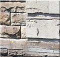
Ordnance Survey Cut Mark
This OS cut mark can be found on No76 Tan-y-groes Street. It marks a point 13.140m above mean sea level.
Image: © Adrian Dust Taken: 6 May 2020
0.04 miles
2
English Congregational Church, Port Talbot
Situated in Grange Street at the corner with Talcennau Road, this Church dates from 1910. Services are held here every Sunday at 11.00am. Its postcode is SA13 1EN.
Image: © David Hillas Taken: 23 Aug 2011
0.07 miles
3
Ordnance Survey Cut Mark
This OS cut mark can be found on the SE face of Dyffryn Lower School. It marks a point 13.164m above mean sea level.
Image: © Adrian Dust Taken: 6 May 2020
0.10 miles
4
Port Talbot : George Street
George Street in Port Talbot as seen from the junction with York Place and Talcennau Road.
Image: © Lewis Clarke Taken: 2 Mar 2014
0.11 miles
5
Aberavon Rugby Football Club Ground
Taken from the M4 motorway.
Image: © Clint Mann Taken: 19 Aug 2014
0.11 miles
6
M4 eastbound at junction 40
Image: © Ian S Taken: 23 Jan 2015
0.11 miles
7
Aberavon RFC
Image: © David Dixon Taken: 7 Sep 2011
0.11 miles
8
Ordnance Survey Cut Mark
This OS cut mark can be found on north angle of the Central Junior School. It marks a point 10.324m above mean sea level.
Image: © Adrian Dust Taken: 6 May 2020
0.12 miles
9
M4, Junction 40
Image: © N Chadwick Taken: 25 Aug 2013
0.12 miles
10
Ordnance Survey Cut Mark
This OS cut mark can be found on No122 Tan-y-groes Street. It marks a point 15.258m above mean sea level.
Image: © Adrian Dust Taken: 6 May 2020
0.13 miles
  • ...