IMAGES TAKEN NEAR TO
Glan Pelenna, PORT TALBOT, SA12 9UA

Introduction

This page details the photographs taken nearby to Glan Pelenna, SA12 9UA by members of the Geograph project.

The Geograph project started in 2005 with the aim of publishing, organising and preserving representative images for every square kilometre of Great Britain, Ireland and the Isle of Man.

There are currently over 7.5m images from over14,400 individuals and you can help contribute to the project by visiting https://www.geograph.org.uk

Image Map


Images are licensed for reuse under creativecommons.org/licenses/by-sa/2.0
Notes
  • Clicking on the map will re-center to the selected point.
  • The higher the marker number, the further away the image location is from the centre of the postcode.

Image Listing (28 Images Found)

Images are licensed for reuse under creativecommons.org/licenses/by-sa/2.0
  • ...
Image
Details
Distance
1
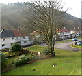
Glan Pelenna houses, Efail Fach
The houses are along the east bank of a river, Afon Pelenna.
Image: © Jaggery Taken: 2 Mar 2012
0.01 miles
2
Houses in Efail Fach
Viewed across the B4287 in Efail Fach, a small village SE of Neath.
Image: © Jaggery Taken: 2 Mar 2012
0.05 miles
3
Bus shelter outside The Colliers, Efail Fach
Viewed across the B4287 in Efail Fach, a small village SE of Neath.
Image: © Jaggery Taken: 2 Mar 2012
0.05 miles
4
Warning signs 50 yards from traffic calming across the B4287 in Efail Fach
The three signs refer to the same spot, where there is a hump in the middle of a 5 metre long narrowing of the roadway, where oncoming traffic has priority.
Image: © Jaggery Taken: 2 Mar 2012
0.05 miles
5
Dining Area with a View
Behind the Colliers Arms is a dining area overlooking the Pelenna river.
Image: © Alan Hughes Taken: 20 Jul 2017
0.06 miles
6
The Colliers Arms
The Colliers Arms, Efail Fach, on the B4287 to Neath.
Image: © Alan Hughes Taken: 20 Jul 2017
0.06 miles
7
The Colliers, Efail Fach
The name sign shows "The Colliers at Pontrhydyfen incorporating the Riverside restaurant", though the location is the village of Efail Fach, north of Pontrhydyfen.
Image: © Jaggery Taken: 2 Mar 2012
0.06 miles
8
The Colliers at Efail-fach.
Image: © Colin Pyle Taken: 1 Sep 2009
0.07 miles
9
Old railway bridge at Efail Fach
Update: Geograph contributor Ceri Jones reports that this bridge was demolished in 2017 by the owner of the adjacent Chapel House.
Image: © John Finch Taken: 15 Nov 2009
0.07 miles
10
Southern boundary of Efail Fach
The B4287 from Pontrhydyfen passes the boundary sign for Efail Fach, a small village SE of Neath.
Image: © Jaggery Taken: 2 Mar 2012
0.09 miles
  • ...