1
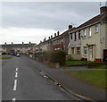
Acacia Close, Port Talbot
Viewed from the Acacia Avenue end.
Image: © Jaggery
Taken: 8 Mar 2012
0.07 miles
2
You are now entering a densely populated area - please drive carefully, Port Talbot
Located alongside Southdown Road near the A4241 Afan Way junction. This is the first time I've seen a sign with this wording, though the message applies in countless other locations.
Image: © Jaggery
Taken: 8 Mar 2012
0.11 miles
3
Sandfields, Aberafan
Tai ac Eglwys yn Sandfields, Aberafan / Houses and a Church in Sandfields, Aberafan
Image: © Ian Medcalf
Taken: 27 Dec 2008
0.11 miles
4
First Cymru Bus Depot, Port Talbot (1)
This photo taken from Southdown Road shows the offices of this bus depot. Originally, this depot was owned by Thomas Bros (Port Talbot) Ltd until it was taken over some years ago by The South Wales Transport Co.Ltd. Now it is owned by First Cymru, but a blue and red board on the building indicates that it is to be sold for future redevelopment.
Image: © David Hillas
Taken: 11 Feb 2017
0.12 miles
5
Underpass beneath Afan Way, Port Talbot
The underpass leads to paths inside a 60 metre diameter roundabout.
Image: © Jaggery
Taken: 8 Mar 2012
0.13 miles
6
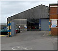
Entrance to First Cymru Port Talbot bus depot
A 5 mph speed limit applies here, on the NW side of the depot. http://www.geograph.org.uk/photo/3831384
Image: © Jaggery
Taken: 8 Mar 2012
0.14 miles
7
First Cymru Port Talbot bus depot
Viewed across Acacia Avenue from the corner of Acacia Close.
http://www.geograph.org.uk/photo/3831398 to a view of the depot entrance.
Image: © Jaggery
Taken: 8 Mar 2012
0.15 miles
8
First Cymru Bus Depot, Port Talbot (2)
Taken from Acacia Avenue SA12 7DW, this photo shows the parking area for the eighty odd First Cymru buses that are based here. However, as the bus depot is now up for sale, these vehicles will have to be dispersed to other bus depots nearby in due course.
Image: © David Hillas
Taken: 11 Feb 2017
0.16 miles
9
Entrance to Lidl in Port Talbot
Located near the A4241 Afan Way in the Sandfields area of Port Talbot.
Image: © Jaggery
Taken: 8 Mar 2012
0.19 miles
10
Sandfields
Mainly Residential - from the North East
Image: © Chris Shaw
Taken: Unknown
0.20 miles


