1
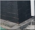
Ordnance Survey Cut Mark
This OS cut mark can be found on No61 Sandown Road. It marks a point 9.781m above mean sea level.
Image: © Adrian Dust
Taken: 4 May 2020
0.06 miles
2
Vivian Park Great War Memorial, Port Talbot
The inscription on the base shows that the memorial was erected
by Robert B. Byass & Company in memory of their employees
who died in the Great War (1914-1918).
The Great War is now generally known as the First World War.
Image: © Jaggery
Taken: 8 Mar 2012
0.11 miles
3
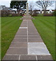
Path to the Great War Memorial in Vivian Park, Port Talbot
http://www.geograph.org.uk/photo/3830828 to a closer view of the Memorial.
Image: © Jaggery
Taken: 8 Mar 2012
0.11 miles
4
Ordnance Survey Cut Mark
This OS cut mark can be found on The Red Dragon PH. It marks a point 11.073m above mean sea level.
Image: © Adrian Dust
Taken: 4 May 2020
0.12 miles
5
Southern entrance to Vivian Park, Port Talbot
From Moorland Road, opposite the Wheatley Avenue junction.
Image: © Jaggery
Taken: 8 Mar 2012
0.13 miles
6
Vivian Park bowling green, Port Talbot
One of two bowling greens side by side. A small part of the second green is in the upper right corner.
Image: © Jaggery
Taken: 8 Mar 2012
0.14 miles
7
Bench and pavilion in Vivian Park, Port Talbot
On the north side of a bowling green. http://www.geograph.org.uk/photo/3830770
Image: © Jaggery
Taken: 8 Mar 2012
0.14 miles
8
21st century houses in Port Talbot
Recently-built houses in Hospital Road.
Image: © Jaggery
Taken: 8 Mar 2012
0.21 miles
9
Port Talbot St John Ambulance HQ
Located in Dalton Road Community Centre, viewed across Vivian Park Drive.
A Port Talbot Mencap Society nameplate is on the wall next to the St John Ambulance nameplate.
Image: © Jaggery
Taken: 8 Mar 2012
0.21 miles
10
Ordnance Survey Rivet
This OS rivet can be found on the wall post SE side of The Poplars. It marks a point 9.662m above mean sea level.
Image: © Adrian Dust
Taken: 4 May 2020
0.22 miles


