1
Gate posts at the B4242 end of Aberpergwm House grounds, Glynneath
The massive gate posts formerly held the gates at the entrance from the B4242 to the grounds of Aberpergwm House. The house is now in ruins and the gates are long gone. The driveway leads to the Grade II* listed Church of St Cadoc http://www.geograph.org.uk/photo/2585919 behind the camera.
Image: © Jaggery
Taken: 4 Sep 2011
0.07 miles
2
Main road from Glynneath to Banwen
A4109 heading towards Glynneath.
Image: © Alan Hughes
Taken: 9 Nov 2020
0.09 miles
3
Flood prevention wall, Glynneath
This is a section of the wall built as part of the Glynneath flood prevention scheme. http://www.geograph.org.uk/photo/2576900
It runs along the north bank of the River Neath.
Image: © Jaggery
Taken: 7 Aug 2011
0.09 miles
4
Vale of Neath Leisure Centre, Glynneath
The leisure centre and car park are on the east side of Chain Road.
Image: © Jaggery
Taken: 7 Aug 2011
0.11 miles
5
Chain Road houses, Glynneath
Houses at the northern end of Chain Road viewed from near the edge of the B4242.
Image: © Jaggery
Taken: 7 Aug 2011
0.12 miles
6
Ordnance Survey Rivet
This OS rivet can be found on the low wall, SW side of the entrance. It marks a point 49.091m above mean sea level.
Image: © Adrian Dust
Taken: 13 Sep 2017
0.12 miles
7
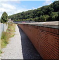
Footpath alongside the flood prevention wall, Glynneath
The path is along the north bank of the River Neath. The flood prevention scheme was officially opened in January 2009. http://www.geograph.org.uk/photo/2576900
Image: © Jaggery
Taken: 7 Aug 2011
0.12 miles
8
River Neath flows towards Chain Road, Glynneath
Viewed from the southern end of Chain Road. http://www.geograph.org.uk/photo/2576835
Ahead are Craig Nedd houses. Out shot on the right is the A465.
Image: © Jaggery
Taken: 7 Aug 2011
0.12 miles
9
Glynneath Flood Prevention plaque
The plaque on the flood prevention wall on the north bank of the River Neath records the official opening on January 30th 2009.
Image: © Jaggery
Taken: 7 Aug 2011
0.12 miles
10
Ordnance Survey Cut Mark
This OS cut mark can be found on the SW parapet of the bridge over the River Neath. It marks a point 48.521m above mean sea level. http://www.geograph.org.uk/photo/4308559
Image: © Adrian Dust
Taken: 11 Jan 2015
0.13 miles


