1
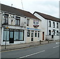
Resolven Post Office
Located at 14 Commercial Road. Next door is Golden Star, a takeaway selling Chinese and English food.
Image: © Jaggery
Taken: 31 Jul 2011
0.04 miles
2
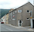
Fish & chip shop for sale, Resolven
An estate agent's notice on 10 Commercial Road offers the property and business for sale.
Image: © Jaggery
Taken: 31 Jul 2011
0.04 miles
3
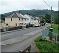
Corner of Ynys Fach Avenue and Clydach Avenue, Resolven
The right turn is into Clydach Avenue. http://www.geograph.org.uk/photo/2531902
Image: © Jaggery
Taken: 31 Jul 2011
0.04 miles
4
Resolven Health Centre
Located on Ynys Fach Avenue, on the west bank of Clydach Brook.
Image: © Jaggery
Taken: 31 Jul 2011
0.04 miles
5
Clydach Brook, Resolven
The brook here flows between Resolven Health Centre http://www.geograph.org.uk/photo/2531871 and Clydach Avenue. http://www.geograph.org.uk/photo/2531902
The brook is a tributary of the River Neath, into which it flows about 300 metres behind the camera.
Image: © Jaggery
Taken: 31 Jul 2011
0.04 miles
6
Clydach Avenue, Resolven
Viewed from the corner of Ynys Fach Avenue. Out of shot on the right is Clydach Brook. http://www.geograph.org.uk/photo/2531891
Image: © Jaggery
Taken: 31 Jul 2011
0.04 miles
7
Millenium Rail Ltd, Resolven
Premises at 25 Commercial Road, opposite Cory Street.
The business's name is missing an 'n' from the usual spelling of millennium. The 'rail' part of the name is a mystery, as various online references show that this is a recruitment agency. Recruiting only railway workers would probably be overly restrictive in the small village of Resolven...
Image: © Jaggery
Taken: 31 Jul 2011
0.05 miles
8
Shaan Tandoori Restaurant, Resolven
Located at 21 Commercial Road.
Image: © Jaggery
Taken: 31 Jul 2011
0.05 miles
9
Across the Neath Valley
Overlooking Resolven.
Image: © Alan Hughes
Taken: 30 Jan 2023
0.08 miles
10
Sardis Baptist Church, Resolven
Located on the corner of Commercial Road (B4434) and John Street.
The church opened in 1904, replacing the smaller chapel http://www.geograph.org.uk/photo/2531845 on the right, dating from 1864.
Image: © Jaggery
Taken: 31 Jul 2011
0.09 miles


