IMAGES TAKEN NEAR TO
Ynys-Arwed, NEATH, SA11 4DF
Introduction
This page details the photographs taken nearby to Ynys-Arwed, SA11 4DF by members of the Geograph project.
The Geograph project started in 2005 with the aim of publishing, organising and preserving representative images for every square kilometre of Great Britain, Ireland and the Isle of Man.

There are currently over 7.5m images from over14,400 individuals and you can help contribute to the project by visiting https://www.geograph.org.uk
Image Map
Images are licensed for reuse under creativecommons.org/licenses/by-sa/2.0
Notes
- Clicking on the map will re-center to the selected point.
- The higher the marker number, the further away the image location is from the centre of the postcode.
Image Listing (15 Images Found)
Images are licensed for reuse under creativecommons.org/licenses/by-sa/2.0
Image
Details
Distance
1

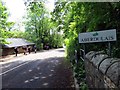
Canalside gardens, Ynys Arwed Cottages
Gardens behind row of houses on Neath Road.
Image: © M J Roscoe
Taken: 1 Oct 2021
0.02 miles
2
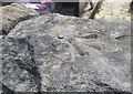
Ordnance Survey Rivet
This OS rivet can be found on the south parapet of the bridge. It marks a point 24.164m above mean sea level.
Image: © Adrian Dust
Taken: 23 Apr 2020
0.02 miles
3

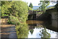
Pipe over Neath Canal at Ynys Arwed Cottages
The metal pipe is probably carrying sewage to a treatment plant on the right, out of shot. The yellow notice on the brick pillar says, 'Mind your head'.
Image: © M J Roscoe
Taken: 1 Oct 2021
0.03 miles
4
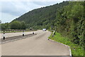
Entrance to lay-by, A465
Lay-by on eastbound carriage way; the coniferous woodland is on Craig Ynysbwllog
Image: © M J Roscoe
Taken: 7 Aug 2023
0.09 miles
5
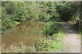
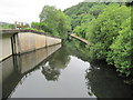
Neath Canal just above footbridge
Vegetation appears to be encroaching on the canal here; the brown colour is probably the result of recent heavy rain.
Image: © M J Roscoe
Taken: 1 Oct 2021
0.13 miles
6
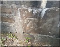
Ordnance Survey Cut Mark
This OS cut mark can be found on the NW parapet of the bridge. It marks a point 25.595m above mean sea level.
Image: © Adrian Dust
Taken: 23 Apr 2020
0.15 miles
7
Ger / Near Aberdulais
Cerddwyr yn dilyn yr B4242 ger Aberdulais. Mae'r heol yn dawel iawn ers adeiladu'r ffordd ddeuol gerllaw.
Walkers following the B4242 near Aberdulais (confluence of the black river). The road is quiet since the opening of the nearby dual carriageway.
Image: © Alan Richards
Taken: 14 Jun 2015
0.16 miles
8
Neath Canal at footbridge next to A465, Ynys-bwllog
The bridge carries the towpath over the end of a realigned section of the canal.
Image: © M J Roscoe
Taken: 1 Oct 2021
0.16 miles
9
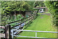
Grass track to bungalow on Neath Road
Driveway from canal towpath Image on approach to bridge.
Image: © M J Roscoe
Taken: 1 Oct 2021
0.17 miles
10
Neath Canal
A section of the Neath Canal that was realigned when the A365 road was upgraded to a dual carriageway.
Image: © David Tyers
Taken: 24 Jun 2017
0.18 miles