IMAGES TAKEN NEAR TO
New Henry Street, NEATH, SA11 1PH

Introduction

This page details the photographs taken nearby to New Henry Street, SA11 1PH by members of the Geograph project.

The Geograph project started in 2005 with the aim of publishing, organising and preserving representative images for every square kilometre of Great Britain, Ireland and the Isle of Man.

There are currently over 7.5m images from over14,400 individuals and you can help contribute to the project by visiting https://www.geograph.org.uk

Image Map


Images are licensed for reuse under creativecommons.org/licenses/by-sa/2.0
Notes
  • Clicking on the map will re-center to the selected point.
  • The higher the marker number, the further away the image location is from the centre of the postcode.

Image Listing (102 Images Found)

Images are licensed for reuse under creativecommons.org/licenses/by-sa/2.0
  • ...
Image
Details
Distance
1
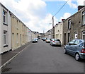
Southgate Street, Neath
Looking WNW from the Briton Ferry Road end.
Image: © Jaggery Taken: 16 Feb 2014
0.03 miles
2
Emanuel Place, Neath
Flats on the corner of Clifford Street and Pendrill Street.
Image: © Jaggery Taken: 29 Apr 2016
0.04 miles
3
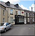
Borough Arms, Neath
Pub at 2 New Henry Street.
Image: © Jaggery Taken: 29 Apr 2016
0.04 miles
4
Bilingual sign on the corner of Henry Street and New Henry Street, Neath
The English/Welsh sign shows Henry Street/Stryd Henry to the left, New Henry Street/Stryd Henry Newydd to the right.
Image: © Jaggery Taken: 29 Apr 2016
0.04 miles
5
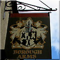
Borough Arms name sign, Neath
The heraldic sign hangs from a wall bracket here. http://www.geograph.org.uk/photo/4945517 The Welsh motto ONI HEUIR NI FEDIR means He who does not sow does not reap.
Image: © Jaggery Taken: 29 Apr 2016
0.04 miles
6
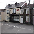
Borough Arms, Neath
Pub at 2 New Henry Street, viewed from Clifford Street.
Image: © Jaggery Taken: 29 Apr 2016
0.04 miles
7
Henry Street, Neath
Towards the Borough Arms pub. http://www.geograph.org.uk/photo/4945517
Image: © Jaggery Taken: 29 Apr 2016
0.04 miles
8
Mary Street/Stryd Mair name sign, Neath
Located on the left here, http://www.geograph.org.uk/photo/4945673 on the corner of Clifford Street at the southern end of Mary Street. An older name sign on the wall above this sign shows only MARY STREET.
Image: © Jaggery Taken: 29 Apr 2016
0.04 miles
9
New Henry Street, Neath
Extending for 130 metres from Henry Street to Bowen Street. The ARMS on the left is part of the Borough Arms pub. http://www.geograph.org.uk/photo/4945625
Image: © Jaggery Taken: 29 Apr 2016
0.05 miles
10
Whittington Street, Neath
Viewed across Briton Ferry Road. Whittington Street has one-way traffic, away from the camera.
Image: © Jaggery Taken: 16 Feb 2014
0.05 miles
  • ...