
IMAGES TAKEN NEAR TO
Heol Gaer, NEATH, SA10 9HT
Introduction
This page details the photographs taken nearby to Heol Gaer, SA10 9HT by members of the Geograph project.
The Geograph project started in 2005 with the aim of publishing, organising and preserving representative images for every square kilometre of Great Britain, Ireland and the Isle of Man.

There are currently over 7.5m images from over14,400 individuals and you can help contribute to the project by visiting https://www.geograph.org.uk
Image Map
Images are licensed for reuse under creativecommons.org/licenses/by-sa/2.0
Notes
- Clicking on the map will re-center to the selected point.
- The higher the marker number, the further away the image location is from the centre of the postcode.
Image Listing (25 Images Found)
Images are licensed for reuse under creativecommons.org/licenses/by-sa/2.0
Image
Details
Distance
2

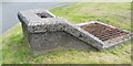
Ordnance Survey Rivet
This OS rivet can be found on the culvert south side of Intervalley Road. It marks a point 237.825m above mean sea level. https://www.geograph.org.uk/photo/6539553
Image: © Adrian Dust
Taken: 17 Jul 2020
0.03 miles
3
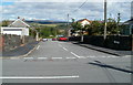
Cross Road, Dyffryn Cellwen
Looking along Cross Road from Main Road.
Image: © Jaggery
Taken: 4 Sep 2011
0.06 miles
4
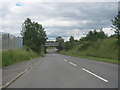
The A4109 heading to pass under a railway bridge at Dyffryn Cellwen
Image: © Peter Robinson
Taken: 20 Jul 2012
0.09 miles
5
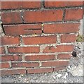
Ordnance Survey Cut Mark
This damaged OS cut mark can be found on the wall of No48 Main Road. It marks a point 246.656m above mean sea level.
Image: © Adrian Dust
Taken: 17 Jul 2020
0.09 miles
6
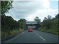
A4109 passes under disused railway bridge
Image: © Colin Pyle
Taken: 19 Sep 2015
0.09 miles
7
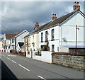
Dyffryn Cellwen houses between the post office and pub
Main Road houses viewed from opposite the post office. http://www.geograph.org.uk/photo/2680677
In the distance, facing School Road, is The Dyffryn pub.
Image: © Jaggery
Taken: 4 Sep 2011
0.12 miles
8

Boarded-up building on the corner of School Road and Main Road, Dyffryn Cellwen
The single-storey building, of unknown former use, is viewed across a play area. http://www.geograph.org.uk/photo/2680551
Image: © Jaggery
Taken: 4 Sep 2011
0.12 miles
9
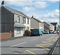
Main Road houses, Dyffryn Cellwen
Viewed from the corner of Cross Road. http://www.geograph.org.uk/photo/2680521
Image: © Jaggery
Taken: 4 Sep 2011
0.12 miles
10
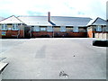
Northern side of Maesmarchog Primary School, Dyffryn Cellwen
Viewed across Main Road.
Image: © Jaggery
Taken: 4 Sep 2011
0.12 miles