IMAGES TAKEN NEAR TO
High Street, BARNSLEY, S75 4JW

Introduction

This page details the photographs taken nearby to High Street, S75 4JW by members of the Geograph project.

The Geograph project started in 2005 with the aim of publishing, organising and preserving representative images for every square kilometre of Great Britain, Ireland and the Isle of Man.

There are currently over 7.5m images from over14,400 individuals and you can help contribute to the project by visiting https://www.geograph.org.uk

Image Map


Images are licensed for reuse under creativecommons.org/licenses/by-sa/2.0
Notes
  • Clicking on the map will re-center to the selected point.
  • The higher the marker number, the further away the image location is from the centre of the postcode.

Image Listing (56 Images Found)

Images are licensed for reuse under creativecommons.org/licenses/by-sa/2.0
  • ...
Image
Details
Distance
1
The Huskar Pit Disaster
Notice attached to the front of the Red Lion public house, Silkstone Lane, where the inquest for the disaster was held.
Image: © John Fielding Taken: 5 Apr 2007
0.05 miles
2
The Red Lion on Silkstone Lane
An inquest was held here on Thursday 6th July 1838 into the deaths of 26 children who drowned in the Huskar Pit 2 days earlier.
Image: © John Fielding Taken: 5 Apr 2007
0.06 miles
3
View from the churchyard, Silkstone
Image: © Jonathan Thacker Taken: 29 Sep 2017
0.09 miles
4
All Saints Church, Silkstone
A Christian church has stood here since before 1066 with the current building dating back to the twelfth century with various additions having been made since it was first built.
Image: © Neil Theasby Taken: 12 Aug 2021
0.10 miles
5
Premises of Tom Horsfield, Rosegrower and Nurseryman
Previously a Methodist Church.
Image: © John Slater Taken: 20 Jun 2014
0.10 miles
6
Silkstone Church
Image: © Dave Pickersgill Taken: 19 Sep 2019
0.11 miles
7
All Saints Church, Silkstone
Image: © JThomas Taken: 3 Oct 2014
0.11 miles
8
All Saints Church at Silksworth
Viewed from the road at Pot House Bridge to the east.
Image: © Peter Wood Taken: 4 Dec 2013
0.11 miles
9
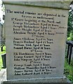
North face of the Huskar disaster monument
In Silkstone churchyard and in memory of the twenty six children who died in a nearby mine on July 4th 1838. The north face of the monument lists the boys who died that terrible day. The girls who died are listed on the south face. For the Huskar Pit page in Wikipedia go here https://en.wikipedia.org/wiki/Huskar_Pit For a full view of the monument go here: https://www.geograph.org.uk/photo/6939977
Image: © Neil Theasby Taken: 12 Aug 2021
0.12 miles
10
Ordnance Survey Flush Bracket S9252
This can be found on the wall of All Saints Church. For more detail see : http://www.bench-marks.org.uk/bm19130
Image: © Peter Wood Taken: 1 Jan 2013
0.12 miles
  • ...