1
Footpath towards Bull Haw Lane
Image: © John Slater
Taken: 20 Jun 2014
0.04 miles
2
Green lane, Silkstone
Image: © JThomas
Taken: 3 Oct 2014
0.06 miles
3
Pack Horse Green, Silkstone
Image: © JThomas
Taken: 3 Oct 2014
0.07 miles
4
Play area off Martin Croft, Silkstone
Image: © Jonathan Thacker
Taken: 29 Sep 2017
0.10 miles
5
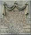
Front face of the Huskar disaster monument
In Silkstone All Saints churchyard. In memory of the twenty six children who died in a nearby coalmine on July 4th 1838. For Wikipedia entry see https://en.wikipedia.org/wiki/Huskar_Pit
For a full view of the monument go here: https://www.geograph.org.uk/photo/6939977
Image: © Neil Theasby
Taken: 12 Aug 2021
0.11 miles
6
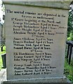
Huskar Disaster Monument in Silkstone churchyard
Erected in memory of the twenty six children who tragically died in the Huskar coalmine disaster of July 4th 1838. For Wikipedia page see https://en.wikipedia.org/wiki/Huskar_Pit
Closer detail of inscriptions:-
Front face of monument:https://www.geograph.org.uk/photo/6939983
North face of monument:https://www.geograph.org.uk/photo/6939991
South face of monument:https://www.geograph.org.uk/photo/6939996
Image: © Neil Theasby
Taken: 12 Aug 2021
0.12 miles
7
South face of the Huskar monument, Silkstone
In All Saints churchyard and in memory of the twenty six children in a nearby coalmine on July 4th, 1838. The south face shows the names of the girls who died that terrible day while the north face lists the names of the boys who died. For the Huskar Pit Wikipedia page go here: https://en.wikipedia.org/wiki/Huskar_Pit
For a full view of the monument go here: https://www.geograph.org.uk/photo/6939977
Image: © Neil Theasby
Taken: 12 Aug 2021
0.12 miles
8
North face of the Huskar disaster monument
In Silkstone churchyard and in memory of the twenty six children who died in a nearby mine on July 4th 1838. The north face of the monument lists the boys who died that terrible day. The girls who died are listed on the south face. For the Huskar Pit page in Wikipedia go here https://en.wikipedia.org/wiki/Huskar_Pit
For a full view of the monument go here: https://www.geograph.org.uk/photo/6939977
Image: © Neil Theasby
Taken: 12 Aug 2021
0.12 miles
9
Church of All Saints from Silkstone Lane
Looking towards All Saints Church from Silkstone Lane. Parts of the building date from at least C12th. A church may have been here since Saxon times.
Image: © Samantha Waddington
Taken: 27 Aug 2011
0.12 miles
10
Premises of Tom Horsfield, Rosegrower and Nurseryman
Previously a Methodist Church.
Image: © John Slater
Taken: 20 Jun 2014
0.13 miles


