IMAGES TAKEN NEAR TO
North Lane, BARNSLEY, S75 4AF
Introduction
This page details the photographs taken nearby to North Lane, S75 4AF by members of the Geograph project.
The Geograph project started in 2005 with the aim of publishing, organising and preserving representative images for every square kilometre of Great Britain, Ireland and the Isle of Man.

There are currently over 7.5m images from over14,400 individuals and you can help contribute to the project by visiting https://www.geograph.org.uk
Image Map
Images are licensed for reuse under creativecommons.org/licenses/by-sa/2.0
Notes
- Clicking on the map will re-center to the selected point.
- The higher the marker number, the further away the image location is from the centre of the postcode.
Image Listing (14 Images Found)
Images are licensed for reuse under creativecommons.org/licenses/by-sa/2.0
Image
Details
Distance
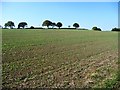
1
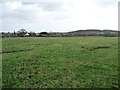
Farmland east of Upper House
On the south side of North Lane.
Image: © Christine Johnstone
Taken: 30 Jan 2013
0.08 miles
2
Public footpath at Upper House
The ladder stile onto North Lane has a neat little gate at the top, which only opens away from the road.
Image: © Christine Johnstone
Taken: 30 Jan 2013
0.10 miles
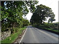
3
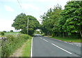
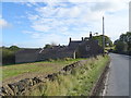
North Lane, Cawthorne
The footpath sign is for a path to South Lane.
Image: © Humphrey Bolton
Taken: 13 Jun 2020
0.12 miles
4
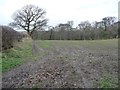
Southern edge of Dixon Wood
Seen from a field gate on North Lane.
Image: © Christine Johnstone
Taken: 30 Jan 2013
0.13 miles
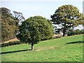
5
Hill top trees
Along the boundary of a greening field between Lane Head Road and North Lane.
Image: © Christine Johnstone
Taken: 28 Sep 2011
0.16 miles
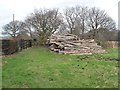
6
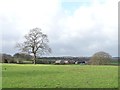
Farmland with trees, north of North Lane
Looking towards the distant Pashley Green Farm.
Image: © Christine Johnstone
Taken: 30 Jan 2013
0.17 miles
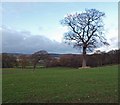
7
Farmland trees near Upper House
On the north side of North Lane.
Image: © Christine Johnstone
Taken: 28 Sep 2011
0.18 miles
8
Isolated trees in farmland near Cawthorne
From North Lane.
Image: © Steve Fareham
Taken: 23 Nov 2008
0.21 miles