IMAGES TAKEN NEAR TO
Rockingham Street, BARNSLEY, S74 0PP
Introduction
This page details the photographs taken nearby to Rockingham Street, S74 0PP by members of the Geograph project.
The Geograph project started in 2005 with the aim of publishing, organising and preserving representative images for every square kilometre of Great Britain, Ireland and the Isle of Man.

There are currently over 7.5m images from over14,400 individuals and you can help contribute to the project by visiting https://www.geograph.org.uk
Image Map
Images are licensed for reuse under creativecommons.org/licenses/by-sa/2.0
Notes
- Clicking on the map will re-center to the selected point.
- The higher the marker number, the further away the image location is from the centre of the postcode.
Image Listing (14 Images Found)
Images are licensed for reuse under creativecommons.org/licenses/by-sa/2.0
Image
Details
Distance
1
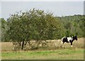
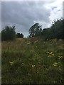
Tankersley Common Side near Hoyland
One of several sad horses tethered on this rough private common land.
Image: © Neil Theasby
Taken: 21 Sep 2014
0.17 miles
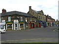
2
Tankersley Common Side
A mix of housing and light industrial units in Hoyland Common.
Image: © Graham Hogg
Taken: 18 Jan 2012
0.18 miles
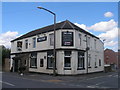
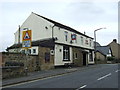
5
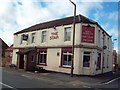
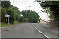
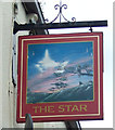
The Star Public House in Hoyland Common
This pub is situated on Hoyland Road, at the junction with Tinker Lane.
Image: © Jonathan Clitheroe
Taken: 5 Oct 2011
0.22 miles
9
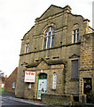
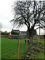
Former Wesleyan Chapel.
Now an office furniture store.
Image: © Steve Fareham
Taken: 20 Sep 2007
0.23 miles