
IMAGES TAKEN NEAR TO
Black Lane, BARNSLEY, S74 0DU
Introduction
This page details the photographs taken nearby to Black Lane, S74 0DU by members of the Geograph project.
The Geograph project started in 2005 with the aim of publishing, organising and preserving representative images for every square kilometre of Great Britain, Ireland and the Isle of Man.

There are currently over 7.5m images from over14,400 individuals and you can help contribute to the project by visiting https://www.geograph.org.uk
Image Map
Images are licensed for reuse under creativecommons.org/licenses/by-sa/2.0
Notes
- Clicking on the map will re-center to the selected point.
- The higher the marker number, the further away the image location is from the centre of the postcode.
Image Listing (41 Images Found)
Images are licensed for reuse under creativecommons.org/licenses/by-sa/2.0
Image
Details
Distance
2
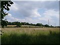
St Peter's Church Tankersley
Our first view of the church. This was our first visit to this part of Tankersely. We had decided on this extension to our walk to check out any surviving evidence of the medieval moat and glebe farm.
Image: © Wendy North
Taken: 26 Jul 2008
0.08 miles
3
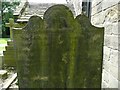
Memento Mori Grave stone - St Peter's churchyard
1804 is a little late for a `memento mori' (remember death) grave stone. These stones were fairly common in the mid to later 18th century. Though not in this churchyard. Note the shape of the top edge of the stone. The hour glass (representing the passing of time and mutability) and the angel (which can variously be interpreted as the soul of the departed, the guardian angel or the angel of death) both typical features of this type of gravestone. Often these stones contain a skull and cross-bones, but not here.
The inscription is difficult to read. I can make out: Sacred to the memory of Thomas Farl_m of Pilley who Departed this life December 12th 1804 aged `could it be possibly be a 100?).
Image: © Wendy North
Taken: 26 Jul 2008
0.08 miles
4
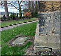
Tankersley, St Peter's church
The benchmark is cut into the south-east face of the church tower.
Image: © Mel Towler
Taken: 16 Dec 2021
0.08 miles
5
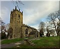
Tankersley, St Peter's church
There is a benchmark cut into the south-east face of the church tower.
Image: © Mel Towler
Taken: 16 Dec 2021
0.08 miles
6
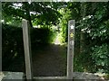
The Barnsley Boundary Walk sign on the stile
The start of our route home through Bull Wood. According to the Tankersley trails leaflet, `It was the custom in the past in northern England to manage holly trees for winter fodder for livestock, especially sheep and deer. These areas of holly fodder were called holly hags. Bull Wood contains a lot of holly and was probably one a holly hag.'
This stile is immediatelt to the left of the information board Image
Image: © Wendy North
Taken: 26 Jul 2008
0.08 miles
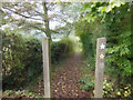
8
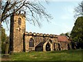
St Peter's Church
Black Lane Tankersley.
Image: © John Fielding
Taken: 21 Apr 2011
0.11 miles
9
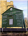
Notice board St Peter's Church Tankersley
For more detail see Image
Image: © Steve Fareham
Taken: 6 Nov 2007
0.12 miles
10
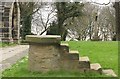
Mounting block in Tankersley Churchyard
Image: © Dave Pickersgill
Taken: 10 Apr 2014
0.12 miles