IMAGES TAKEN NEAR TO
Maytree Close, BARNSLEY, S73 9JS

Introduction

This page details the photographs taken nearby to Maytree Close, S73 9JS by members of the Geograph project.

The Geograph project started in 2005 with the aim of publishing, organising and preserving representative images for every square kilometre of Great Britain, Ireland and the Isle of Man.

There are currently over 7.5m images from over14,400 individuals and you can help contribute to the project by visiting https://www.geograph.org.uk

Image Map


Images are licensed for reuse under creativecommons.org/licenses/by-sa/2.0
Notes
  • Clicking on the map will re-center to the selected point.
  • The higher the marker number, the further away the image location is from the centre of the postcode.

Image Listing (34 Images Found)

Images are licensed for reuse under creativecommons.org/licenses/by-sa/2.0
  • ...
Image
Details
Distance
1
Zooming down Snape Hill.
Road to Wombwell from Darfield.
Image: © Steve Fareham Taken: 22 Jul 2007
0.10 miles
2
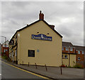
Queen Victoria on Snape Hill.
Image: © Steve Fareham Taken: 15 Aug 2007
0.12 miles
3
Snape Hill Road Convenience Store, Darfield
Image: © Neil Theasby Taken: 13 Nov 2022
0.12 miles
4
The house of the rising sun.
What's left of a once popular pub on Snape Hill.
Image: © Steve Fareham Taken: 22 Jul 2007
0.14 miles
5
A lonely bunch of daffodils
On the site of former housing on New Street. Looking over the Dove Valley to Wombwell.
Image: © Steve Fareham Taken: 1 May 2008
0.14 miles
6
The side of what was The Rising Sun public house
Taken from the gate on Snape Hill. There has been a couple of attempts in recent years to refurb this property with no success.
Image: © Steve Fareham Taken: 1 May 2008
0.14 miles
7
The end of the 'Bottom Club'
Intact at morning and by lunchtime practically demolished Darfield WMC (Working Mens Club) is demolished a sign of the times? The club was only refurbished in 2010.
Image: © Steve Fareham Taken: 4 Jan 2011
0.15 miles
8
New Street?
New street junction with Snape Hill, these houses have been renovated and destroyed several times recently.
Image: © Steve Fareham Taken: 22 Jul 2007
0.15 miles
9
The former Rising Sun Public House
At the junction of New Street and Snape Hill. Built 1876 by Joseph Hill.
Image: © Steve Fareham Taken: 1 May 2008
0.15 miles
10
What was the Rising Sun Public House
The keystone is inscribed JH 1876. JH was the first owner Joseph Hill.
Image: © Steve Fareham Taken: 1 May 2008
0.16 miles
  • ...