IMAGES TAKEN NEAR TO
East Street, BARNSLEY, S73 9AE
Introduction
This page details the photographs taken nearby to East Street, S73 9AE by members of the Geograph project.
The Geograph project started in 2005 with the aim of publishing, organising and preserving representative images for every square kilometre of Great Britain, Ireland and the Isle of Man.

There are currently over 7.5m images from over14,400 individuals and you can help contribute to the project by visiting https://www.geograph.org.uk
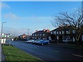
Image Map
Images are licensed for reuse under creativecommons.org/licenses/by-sa/2.0
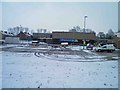
Notes
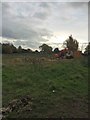
- Clicking on the map will re-center to the selected point.
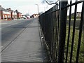
- The higher the marker number, the further away the image location is from the centre of the postcode.
Image Listing (117 Images Found)
Images are licensed for reuse under creativecommons.org/licenses/by-sa/2.0
Image
Details
Distance
1
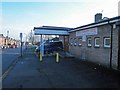
Darfield Community Centre on Illsley Road
For many years it was known as (and still is to many) as Darfield Old Folks Centre. It was used by all sorts of groups.
Image: © Steve Fareham
Taken: 13 Jan 2013
0.05 miles
2
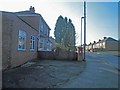
Post box outside former shop
At the junction of North Street and Illsley Road. The part of the building nearest the viewer was the shop and it's been derelict for years and recently turned into an extension to the house. In the 1960s it was called Ennis's shop.
Image: © Steve Fareham
Taken: 13 Jan 2013
0.06 miles
3
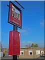
The Darfield ('The New Un')
Built I guess around 1957 the Darfield Hotel (Public House) was always and still is known as 'The New Un'. The pub once fronted with a large red shale car park onto Nanny Marr Road which now contains houses.
Image: © Steve Fareham
Taken: 13 Jan 2013
0.08 miles
4
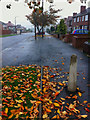
Nanny Marr Road Darfield
On a dank November morning looking down towards 'The Ring' (junction with A635).
Image: © Steve Fareham
Taken: 8 Nov 2011
0.10 miles
5

Looks like work is starting on what was the site of The Foulstone school
Image: © Steve Fareham
Taken: 27 Oct 2016
0.10 miles
6
Nanny Marr Road, Darfield
The road was known as New County Road up to around 1947.
Image: © Steve Fareham
Taken: 7 Apr 2013
0.11 miles
7
Nanny Marr Road Darfield
The road sign shows the directions to Barnsley and Doncaster via the A635 ahead.
The road was originally known as New County Road and changed name around the 1930's?
Image: © Steve Fareham
Taken: 13 Jan 2013
0.11 miles
8
What was the Foulstone school car park
The school is being demolished after the opening of the combined Darfield and Wombwell ALC school Netherwood. Image
Image: © Steve Fareham
Taken: 19 Jan 2013
0.11 miles
9
The site of the former Foulstone school
Image: © Steve Fareham
Taken: 27 Oct 2016
0.12 miles
10
The junction of Illsley Road and Woodhall Road, Darfield
Image: © Steve Fareham
Taken: 13 Jan 2013
0.12 miles