IMAGES TAKEN NEAR TO
Barnsley Road, BARNSLEY, S72 9LH
Introduction
This page details the photographs taken nearby to Barnsley Road, S72 9LH by members of the Geograph project.
The Geograph project started in 2005 with the aim of publishing, organising and preserving representative images for every square kilometre of Great Britain, Ireland and the Isle of Man.

There are currently over 7.5m images from over14,400 individuals and you can help contribute to the project by visiting https://www.geograph.org.uk
Image Map
Images are licensed for reuse under creativecommons.org/licenses/by-sa/2.0
Notes
- Clicking on the map will re-center to the selected point.
- The higher the marker number, the further away the image location is from the centre of the postcode.
Image Listing (48 Images Found)
Images are licensed for reuse under creativecommons.org/licenses/by-sa/2.0
Image
Details
Distance
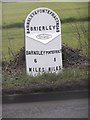
1
Old milepost
This post at the north end of Brierley was completely refurbished in February 2019. Many hours were spent removing all the old paint with various protective coats applied. But it is only 70cm from the edge of this busy road and grit and stones thrown up by passing traffic have taken their toll. It is the only post along this route which has the foundry name, John Lees & Sons, Grove Foundry, Gomersal, Nr Leeds. It is Grade II Listed 1314993.
Image: © Chris Minto
Taken: 10 Apr 2022
0.03 miles
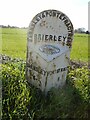
2
Old Milestone by the A628, Barnsley Road, Brierley
Metal plate attached to stone post by the A628, in parish of Brierley (Barnsley District), Barnsley Road, North end of Brierley, 100m East of junction with Frickley Bridge Lane; opposite entrance to Dorwill Cottage Farm, by the road, on South-East side of road. Barnsley/Pontefract, Grove iron casting erected by the County Council in the 19th/20th century.
Inscription reads:-
: BARNSLEY / 6 / MILES : : BARNSLEY & PONTEFRACT ROAD / BRIERLEY : : PONTEFRACT / 8 / MILES :
Maker:-
: JOHN LEES & SONS / GROVE FOUNDRY / GOMERSALL / Nr LEEDS :
Grade II listed.
List Entry Number: 1314993 https://historicengland.org.uk/listing/the-list/list-entry/1314993
Milestone Society National ID: YS_BNPO06.
Image: © Milestone Society
Taken: 5 Mar 2019
0.03 miles
3
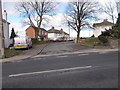
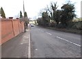
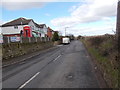
Barnsley Road - viewed from Frickley Bridge Lane
Image: © Betty Longbottom
Taken: 24 Feb 2017
0.04 miles
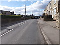
4
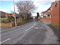
Frickley Bridge Lane - Barnsley Road
Image: © Betty Longbottom
Taken: 24 Feb 2017
0.05 miles
5
Cross Hill - viewed from Frickley Bridge Lane
Image: © Betty Longbottom
Taken: 24 Feb 2017
0.07 miles
6
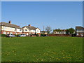
Hilltop Estate, Brierley
This small housing estate takes the form of an oval of houses around a central green. There is evidence of mining subsidence, seen in the missing pair of semis and the half of a semi remaining.
Image: © Carol Rose
Taken: 27 Apr 2007
0.07 miles
8
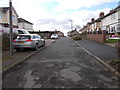
Frickley Bridge Lane - viewed from Hill Top
Image: © Betty Longbottom
Taken: 24 Feb 2017
0.10 miles