IMAGES TAKEN NEAR TO
Low Farm Court, BARNSLEY, S71 5FD

Introduction

This page details the photographs taken nearby to Low Farm Court, S71 5FD by members of the Geograph project.

The Geograph project started in 2005 with the aim of publishing, organising and preserving representative images for every square kilometre of Great Britain, Ireland and the Isle of Man.

There are currently over 7.5m images from over14,400 individuals and you can help contribute to the project by visiting https://www.geograph.org.uk

Image Map


Images are licensed for reuse under creativecommons.org/licenses/by-sa/2.0
Notes
  • Clicking on the map will re-center to the selected point.
  • The higher the marker number, the further away the image location is from the centre of the postcode.

Image Listing (27 Images Found)

Images are licensed for reuse under creativecommons.org/licenses/by-sa/2.0
  • ...
Image
Details
Distance
1
Edderthorpe
Hamlet to the north of Darfield which boasts several character buildings.
Image: © Jonathan Clitheroe Taken: 4 Jan 2017
0.04 miles
2
Approaching Edderthorpe from Darfield
Image: © Bill Henderson Taken: 4 Feb 2007
0.04 miles
3
Sandstone causey
An example of a local stone causey (or pavement) laid to reduce the wear on the otherwise soft road surface by pack-horses. The trust maintaining the nearby Doncaster to Saltersbrook turnpike road were laying just such pavements on parts of their road between Marr and Darfield around 1740 to 1760. There is quite a lot more of this causey heading towards Cudworth, before Crookes Farm, emerging from under the modern tarmacadam covering. The lane leads to the pack-horse bridge and staircase at Storrs Wood by the river Dearne adjacent to Cudworth.
Image: © John Orchard Taken: 29 Jul 2012
0.05 miles
4
Middle Farm, Edderthorpe
Image: © John Slater Taken: 7 Oct 2013
0.06 miles
5
Edderthorpe footpath
Currently the footpath part of the Dearne way is invisible as the field has recently been ploughed.
Image: © Steve Fareham Taken: 1 Jan 2009
0.06 miles
6
Rebuild of barns to luxury housing.
Bridleway at side called 'priestcroft'.
Image: © Steve Fareham Taken: 17 Apr 2004
0.07 miles
7
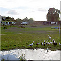
Duck pond.
At Ash tree farm stables.
Image: © Steve Fareham Taken: 6 Aug 2007
0.08 miles
8
Farmhouse at Edderthorpe
Image: © Richard Spencer Taken: 5 Feb 2006
0.08 miles
9
Start of Priestcroft lane.
Image: © Steve Fareham Taken: 6 Aug 2007
0.10 miles
10
Ash Tree Stables, from Crook House Lane
Image: © Ian S Taken: 29 Jul 2011
0.10 miles
  • ...