Sandstone causey
Introduction
The photograph on this page of Sandstone causey by John Orchard as part of the Geograph project.
The Geograph project started in 2005 with the aim of publishing, organising and preserving representative images for every square kilometre of Great Britain, Ireland and the Isle of Man.

There are currently over 7.5m images from over 14,400 individuals and you can help contribute to the project by visiting https://www.geograph.org.uk
Sandstone causey
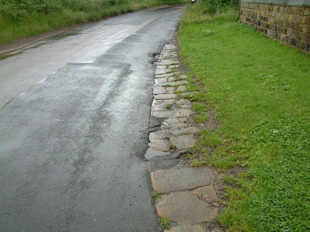
Image: © John Orchard Taken: 29 Jul 2012
An example of a local stone causey (or pavement) laid to reduce the wear on the otherwise soft road surface by pack-horses. The trust maintaining the nearby Doncaster to Saltersbrook turnpike road were laying just such pavements on parts of their road between Marr and Darfield around 1740 to 1760. There is quite a lot more of this causey heading towards Cudworth, before Crookes Farm, emerging from under the modern tarmacadam covering. The lane leads to the pack-horse bridge and staircase at Storrs Wood by the river Dearne adjacent to Cudworth.
Images are licensed for reuse under creativecommons.org/licenses/by-sa/2.0
Image Location
Latitude
53.546964
Longitude
-1.380893