IMAGES TAKEN NEAR TO
Doncaster Road, BARNSLEY, S71 5ER
Introduction
This page details the photographs taken nearby to Doncaster Road, S71 5ER by members of the Geograph project.
The Geograph project started in 2005 with the aim of publishing, organising and preserving representative images for every square kilometre of Great Britain, Ireland and the Isle of Man.

There are currently over 7.5m images from over14,400 individuals and you can help contribute to the project by visiting https://www.geograph.org.uk
Image Map
Images are licensed for reuse under creativecommons.org/licenses/by-sa/2.0
Notes
- Clicking on the map will re-center to the selected point.
- The higher the marker number, the further away the image location is from the centre of the postcode.
Image Listing (19 Images Found)
Images are licensed for reuse under creativecommons.org/licenses/by-sa/2.0
Image
Details
Distance
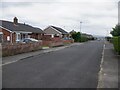
2
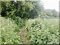
Fields, Ardsley
The first field beyond the houses on Lees Hill.
Image: © Richard Webb
Taken: 30 May 2023
0.08 miles
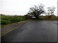
3
Beginning or end?
Start or finish of overhead power cables.
Image: © Steve Fareham
Taken: 22 Jul 2007
0.08 miles
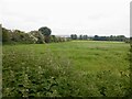
5
Lees Hill
End of Ennerdale Drive near gate with Martin Richardson then onto bag the trig called Ardsley.
Name: Lees Hill
Hill number: 16843
Height: 105m / 344ft
Parent (Ma/M): 2810 Black Hill
Section: 36: Lancashire, Cheshire & the Southern Pennines
County/UA: Barnsley (UA)
Class: Tump (100-199m)
Grid ref: SE 38730 05819
Summit feature: hedgebank by sign on N side of gate
Drop: 54m
Col: 51m
Image: © Rude Health
Taken: 23 Nov 2014
0.10 miles

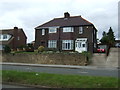
7
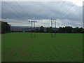
Crop field and power lines
South of Doncaster Road.
Image: © JThomas
Taken: 27 Sep 2014
0.11 miles
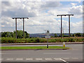
8
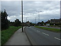
Doncaster Road (A635)
Heading west towards Barnsley.
Image: © JThomas
Taken: 27 Sep 2014
0.12 miles
9
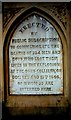
Oaks colliery memorial plaque
The plaque inscription speaks for itself.
Image: © derek dye
Taken: 21 May 2004
0.13 miles