
IMAGES TAKEN NEAR TO
Doncaster Road, BARNSLEY, S71 5AG
Introduction
This page details the photographs taken nearby to Doncaster Road, S71 5AG by members of the Geograph project.
The Geograph project started in 2005 with the aim of publishing, organising and preserving representative images for every square kilometre of Great Britain, Ireland and the Isle of Man.

There are currently over 7.5m images from over14,400 individuals and you can help contribute to the project by visiting https://www.geograph.org.uk
Image Map
Images are licensed for reuse under creativecommons.org/licenses/by-sa/2.0
Notes
- Clicking on the map will re-center to the selected point.
- The higher the marker number, the further away the image location is from the centre of the postcode.
Image Listing (38 Images Found)
Images are licensed for reuse under creativecommons.org/licenses/by-sa/2.0
Image
Details
Distance
1
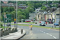
Approaching Stairfoot Roundabout
The A635 descends into a small valley off the Dearne Valley. This is effectively the beginning of the Barnsley conurbation.
Image: © Bill Boaden
Taken: 26 May 2014
0.04 miles
3
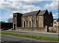
Antiques Emporium on Doncaster Road, Ardsley
As the architecture suggests it was once a chapel serving the local community.
Image: © Neil Theasby
Taken: 26 Apr 2015
0.09 miles
4

Doncaster Road
National Cycle Network route 67 which runs along a dismantled section of the former Hull and Barnsley railway crosses the road here.
Image: © DS Pugh
Taken: 13 Apr 2025
0.13 miles
5
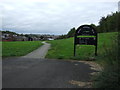
Trans Pennine Trail, Stairfoot
Looking north
Image: © JThomas
Taken: 27 Sep 2014
0.13 miles
6
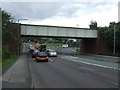
Disused Railway bridge over the A635
Now used by the Trans Pennine Trail.
Image: © JThomas
Taken: 27 Sep 2014
0.14 miles
7
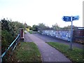
Footbridge over Stairfoot Roundabout
Bridge and signpost marking another branching of the Trans Pennine Trail.
Image: © Jonathan Clitheroe
Taken: 7 Oct 2011
0.14 miles
8
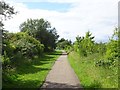
Stairfoot 2nd railway station (site), Yorkshire
Opened in 1871 by the Manchester Sheffield & Lincolnshire Railway on the line from Doncaster to Barnsley, this station replaced an earlier 1851 station immediately behind the camera position. In turn, the 1871 station closed to passengers in 1957.
View north west along the track-bed towards Barnsley. The modern A635 under-bridge in the centre of the image cuts across where the 2 parallel platforms were. The track-bed is now a public footpath.
Image: © Nigel Thompson
Taken: 11 Jul 2020
0.14 miles
9
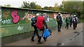
Bridge along the Trans Pennine trail.
Stairfoot in Barnsley.
Image: © steven ruffles
Taken: 6 Oct 2018
0.15 miles
10
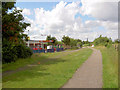
McDonald's on Trans Pennine trail Stairfoot.
Is this the only cycle through McDonald's on the trail?
Image: © Steve Fareham
Taken: 22 Jul 2007
0.15 miles