IMAGES TAKEN NEAR TO
North Royds Wood, BARNSLEY, S71 3NW

Introduction

This page details the photographs taken nearby to North Royds Wood, S71 3NW by members of the Geograph project.

The Geograph project started in 2005 with the aim of publishing, organising and preserving representative images for every square kilometre of Great Britain, Ireland and the Isle of Man.

There are currently over 7.5m images from over14,400 individuals and you can help contribute to the project by visiting https://www.geograph.org.uk

Image Map


Images are licensed for reuse under creativecommons.org/licenses/by-sa/2.0
Notes
  • Clicking on the map will re-center to the selected point.
  • The higher the marker number, the further away the image location is from the centre of the postcode.

Image Listing (6 Images Found)

Images are licensed for reuse under creativecommons.org/licenses/by-sa/2.0
Image
Details
Distance
1
On Ollerton Road, Athersley North
Part of a large zone of post-war social housing.
Image: © Neil Theasby Taken: 4 Jan 2022
0.14 miles
2
Not the best architecture in Barnsley
Rear of Athersley leisure centre now showing its age.
Image: © Steve Fareham Taken: 27 Oct 2007
0.20 miles
3
Ollerton Road, Athersley North
Image: © Neil Theasby Taken: 4 Jan 2022
0.22 miles
4
Athersley Leisure Centre
Leisure centre on the Athersley (North) Estate.
Image: © Roger May Taken: 28 May 2006
0.23 miles
5
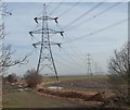
Pylon Near Athersley North
The UK national grid spans the country connecting power stations to the users. This particular pylon gives a slight change of direction to take the cables over the disused railway bridge on Wakefield Road near to the Eastfield Arms.
Image: © Martin Lee Taken: Unknown
0.25 miles
6
Pylons heading east, near Athersley North
Seen from the former railway line.
Image: © Christine Johnstone Taken: 16 Feb 2013
0.25 miles