IMAGES TAKEN NEAR TO
Clarendon Street, BARNSLEY, S70 6AJ
Introduction
This page details the photographs taken nearby to Clarendon Street, S70 6AJ by members of the Geograph project.
The Geograph project started in 2005 with the aim of publishing, organising and preserving representative images for every square kilometre of Great Britain, Ireland and the Isle of Man.

There are currently over 7.5m images from over14,400 individuals and you can help contribute to the project by visiting https://www.geograph.org.uk
Image Map
Images are licensed for reuse under creativecommons.org/licenses/by-sa/2.0
Notes
- Clicking on the map will re-center to the selected point.
- The higher the marker number, the further away the image location is from the centre of the postcode.
Image Listing (33 Images Found)
Images are licensed for reuse under creativecommons.org/licenses/by-sa/2.0
Image
Details
Distance
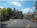
2
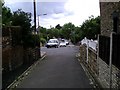
The bottom of Park Grove, junc. Princess Street
Image: © Peter Beard
Taken: 6 Feb 2007
0.08 miles
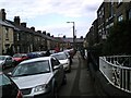
3
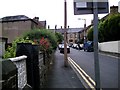
Making a clean sweep on Racecommon Road
Image: © Chris Morgan
Taken: 2 Sep 2022
0.09 miles
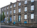
5
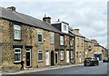
Barnsley Street Scene
Agnes Road seen here joining Park Grove.
Image: © Jonathan Clitheroe
Taken: 27 Jun 2015
0.13 miles
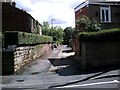
9
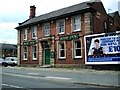
The Shaw Inn, Racecommon Road, Barnsley
Image: © Peter Beard
Taken: 28 Jun 2007
0.15 miles
10
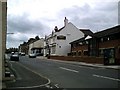
The Longcar Inn, Racecommon Road, Barnsley
Image: © Peter Beard
Taken: 28 Jun 2007
0.15 miles