
IMAGES TAKEN NEAR TO
West View Terrace, BARNSLEY, S70 5PQ
Introduction
This page details the photographs taken nearby to West View Terrace, S70 5PQ by members of the Geograph project.
The Geograph project started in 2005 with the aim of publishing, organising and preserving representative images for every square kilometre of Great Britain, Ireland and the Isle of Man.

There are currently over 7.5m images from over14,400 individuals and you can help contribute to the project by visiting https://www.geograph.org.uk
Image Map
Images are licensed for reuse under creativecommons.org/licenses/by-sa/2.0
Notes
- Clicking on the map will re-center to the selected point.
- The higher the marker number, the further away the image location is from the centre of the postcode.
Image Listing (21 Images Found)
Images are licensed for reuse under creativecommons.org/licenses/by-sa/2.0
Image
Details
Distance
1
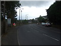
West Street, Worsbrough (B6100)
Heading south west.
Image: © JThomas
Taken: 27 Sep 2014
0.03 miles
2

House building site off West Street
The site of the Worsbrough Branch Canal and Dearne & Dove Saw Mills, seen from fencing on the Trans Pennine Trail.
Image: © Kevin Waterhouse
Taken: 18 Sep 2025
0.08 miles
3

Worsbrough - The Greyhound
On High Street.
Image: © Dave Bevis
Taken: 3 May 2014
0.11 miles

6

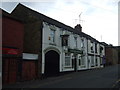
The Greyhound
A public house on High Street
Image: © Kevin Waterhouse
Taken: 18 Sep 2025
0.11 miles
8
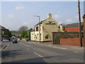
The Mason's Arms Public House
Which stands at the crossroads of East Street, West Street, High Street and Station Road.
Image: © Carol Rose
Taken: 27 Apr 2007
0.13 miles
9
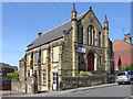
Worsbrough - Community Church
On High Street. The stonework on the east-facing frontage has the following inscriptions "AD 1903" (near the gable-end apex) and "Ebenezer Wesleyan Reform" (half way down). There are also foundation stones (two either side of the doorway) inscribed with "EBENEZER CHAPEL 1854". This suggests that the chapel was built in 1854 and extended upwards in 1903. See http://www.waymarking.com/waymarks/WMDK8M_1854_Ebenezer_Chapel_Worsbrough_Barnsley for more details.
Image: © Dave Bevis
Taken: 3 May 2014
0.14 miles
10
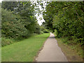
Manicured part of the Trans Pennine Trail.
Image: © Steve Fareham
Taken: 2 Sep 2007
0.14 miles