IMAGES TAKEN NEAR TO
Coach House Lane, BARNSLEY, S70 4EU
Introduction
This page details the photographs taken nearby to Coach House Lane, S70 4EU by members of the Geograph project.
The Geograph project started in 2005 with the aim of publishing, organising and preserving representative images for every square kilometre of Great Britain, Ireland and the Isle of Man.

There are currently over 7.5m images from over14,400 individuals and you can help contribute to the project by visiting https://www.geograph.org.uk
Image Map
Images are licensed for reuse under creativecommons.org/licenses/by-sa/2.0
Notes
- Clicking on the map will re-center to the selected point.
- The higher the marker number, the further away the image location is from the centre of the postcode.
Image Listing (15 Images Found)
Images are licensed for reuse under creativecommons.org/licenses/by-sa/2.0
Image
Details
Distance
1
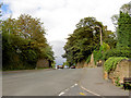
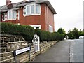
At the top of Mount Vernon.
The hospital is at the brow of the hill on the left.
Image: © Steve Fareham
Taken: 6 Sep 2007
0.08 miles
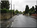

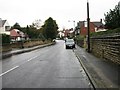
8
Semis stepping down Highstone Lane, Ward Green
The roofs are level in each pair of houses, but the windows are not.
Image: © Christine Johnstone
Taken: 9 Mar 2018
0.17 miles
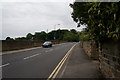
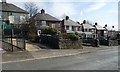
9
Houses on the east side of Highstone Lane
In the Ward Green area of Worsbrough.
Image: © Christine Johnstone
Taken: 9 Mar 2018
0.17 miles
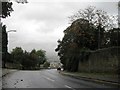
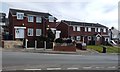
10
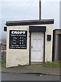
Highstone Lane hairdressers, Worsbrough
A small, and part-time, barber shop where you might be able to get a Barnsley chop, or maybe not.
Image: © Paul Harrop
Taken: 13 Dec 2016
0.18 miles