IMAGES TAKEN NEAR TO
Bluebell Wood Lane, ROTHERHAM, S66 3RX
Introduction
This page details the photographs taken nearby to Bluebell Wood Lane, S66 3RX by members of the Geograph project.
The Geograph project started in 2005 with the aim of publishing, organising and preserving representative images for every square kilometre of Great Britain, Ireland and the Isle of Man.

There are currently over 7.5m images from over14,400 individuals and you can help contribute to the project by visiting https://www.geograph.org.uk
Image Map (Loading...)


Getting Data...Please wait
Leaflet Map data © OpenStreetMap
Images are licensed for reuse under creativecommons.org/licenses/by-sa/2.0
Notes
- Clicking on the map will re-center to the selected point.
- The higher the marker number, the further away the image location is from the centre of the postcode.
Image Listing (5 Images Found)
Images are licensed for reuse under creativecommons.org/licenses/by-sa/2.0
Image
Details
Distance
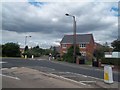
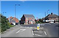
1
Woodlaithes
New Housing on reclaimed land at Woodlaithes
Image: © Richard Croft
Taken: 24 Jul 2006
0.07 miles
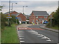
3
Elton Lane new housing off Flanderwell Lane, Sunnyside, Rotherham
Image: © Steve Fareham
Taken: 4 Sep 2012
0.14 miles