
IMAGES TAKEN NEAR TO
Stannington Road, SHEFFIELD, S6 5FT
Introduction
This page details the photographs taken nearby to Stannington Road, S6 5FT by members of the Geograph project.
The Geograph project started in 2005 with the aim of publishing, organising and preserving representative images for every square kilometre of Great Britain, Ireland and the Isle of Man.

There are currently over 7.5m images from over14,400 individuals and you can help contribute to the project by visiting https://www.geograph.org.uk
Image Map
Images are licensed for reuse under creativecommons.org/licenses/by-sa/2.0
Notes
- Clicking on the map will re-center to the selected point.
- The higher the marker number, the further away the image location is from the centre of the postcode.
Image Listing (46 Images Found)
Images are licensed for reuse under creativecommons.org/licenses/by-sa/2.0
Image
Details
Distance
1

View to Stannington, from Bolehill Recreation Ground, Northfield Avenue, Crookes, Sheffield
Image: © Terry Robinson
Taken: 16 Aug 2013
0.05 miles
2
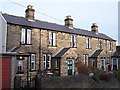
Almshouses, Ivanhoe Road (formerly Ivy Road), Stannington, Sheffield
Dates and details are shown in this link ... Image
Image: © Terry Robinson
Taken: 14 Jan 2009
0.08 miles
3
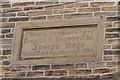
Almshouses Sign, Ivanhoe Road (formerly Ivy Road), Stannington, Sheffield
To view the Almshouses ... see ...
Image
Image: © Terry Robinson
Taken: 14 Jan 2009
0.09 miles
4
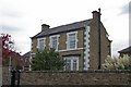
Detached House, Carlby Road, Sheffield
Not sure when but this road has changed from Carr Road to Carlby Road sometime in the last 100 years.
Image: © Terry Robinson
Taken: 29 Oct 2008
0.11 miles
5
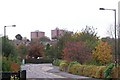
Autumn Colours in Wood Lane, Malin Bridge, Sheffield
Deer Park Tower Blocks are visible in the distance.
Image: © Terry Robinson
Taken: 29 Oct 2008
0.13 miles
6
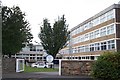
Myers Grove Secondary School, Wood Lane, Sheffield - 2
This School and the (relatively) nearby Wisewood Senior School are due to close and be replaced by a new School - Forge Valley Community School - in 2011. This will be built just to the left of this building, on land which was formerly part of Loxley College, with the buildings now derelict and in a very poor vandalised condition. Follow this link for details of the planned new school ... http://newschool.swclc.net/index.html See also Image Image
Image: © Terry Robinson
Taken: 25 Sep 2008
0.15 miles
7
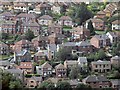
Rivelin Park Road, Stannington
The road can be seen running diagonally across the frame. The mixed row of houses at the bottom of the picture front Low Road.
Image: © Dave Hitchborne
Taken: 26 Aug 2008
0.15 miles
8
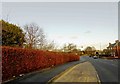
Wood Lane bus stop Stannington
Adjacent to the new Forge Valley School.
Image: © Steve Fareham
Taken: 29 Dec 2015
0.15 miles
9
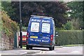
Bob's Buddy, Wood Lane, Malin Bridge, Sheffield
Image: © Terry Robinson
Taken: 25 Sep 2008
0.15 miles
10
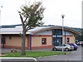
City Learning Centre (Sheffield West), Wood Lane, Sheffield
This CLC covers Sheffield West ... others are situated in the North, South, West parts of the city and other individual locations See this link for more details of the West CLC ... http://swclc.net/ The CLC is close to Myers Grove Secondary School Image
Image: © Terry Robinson
Taken: 25 Sep 2008
0.16 miles