IMAGES TAKEN NEAR TO
Marlowe Road, ROTHERHAM, S65 2JE
Introduction
This page details the photographs taken nearby to Marlowe Road, S65 2JE by members of the Geograph project.
The Geograph project started in 2005 with the aim of publishing, organising and preserving representative images for every square kilometre of Great Britain, Ireland and the Isle of Man.

There are currently over 7.5m images from over14,400 individuals and you can help contribute to the project by visiting https://www.geograph.org.uk
Image Map
Images are licensed for reuse under creativecommons.org/licenses/by-sa/2.0
Notes
- Clicking on the map will re-center to the selected point.
- The higher the marker number, the further away the image location is from the centre of the postcode.
Image Listing (10 Images Found)
Images are licensed for reuse under creativecommons.org/licenses/by-sa/2.0
Image
Details
Distance
1
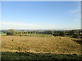
Herringthorpe playing fields from Wickersley Road A6021
Image: © Martin Dawes
Taken: 11 Oct 2014
0.12 miles
2
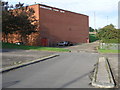
Big Red Leisure Centre
The cars parked next to the wall of Herringthorpe Leisure Centre give a sense of scale to the size of the building.
Image: © Michael Patterson
Taken: 15 Sep 2006
0.16 miles
4
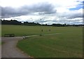
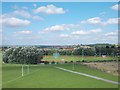
Herringthorpe Playing Fields
Pictured from a path which joins the fields from Wickersley Road. On the left is Rotherham Hospice which has fantastic views over the common and beyond towards the follies of the Wentworth Estate.
The stadium and running track (partially visible on the right) is the scene of my greatest sporting achievement. It was here during a World Mental Health Day charity match against Johnny Quinn's All Stars in October 1998 that I successfully tackled Emlyn Hughes and stole the ball away. Happy memories and a sad shame that Emlyn was to pass away so prematurely.
Image: © Jonathan Clitheroe
Taken: 25 Jun 2017
0.18 miles
5
View to Herringthorpe Stadium from Broom Road
Image: © Neil Theasby
Taken: 16 Aug 2013
0.19 miles
6
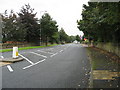
Wickersley Road (A6021) - View from Broom Lane Junction
Image: © Alan Heardman
Taken: 9 Sep 2008
0.19 miles
7
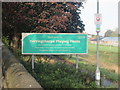
Notice at pedestrian entrance to Herringthorpe Playing Fields
Image: © Martin Dawes
Taken: 11 Oct 2014
0.19 miles
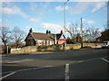
8
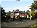
The Homestead public house from Wickersley Road
Image: © Martin Dawes
Taken: 11 Oct 2014
0.23 miles
10
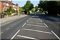
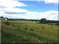
Wickersley Road, Broom.
View along Wickersley Road in Broom, between the junctions at Middle Lane South and Broom Lane.
Image: © Ryk Rak
Taken: 1 Jun 2021
0.25 miles