IMAGES TAKEN NEAR TO
Boswell Street, ROTHERHAM, S65 2ED
Introduction
This page details the photographs taken nearby to Boswell Street, S65 2ED by members of the Geograph project.
The Geograph project started in 2005 with the aim of publishing, organising and preserving representative images for every square kilometre of Great Britain, Ireland and the Isle of Man.

There are currently over 7.5m images from over14,400 individuals and you can help contribute to the project by visiting https://www.geograph.org.uk
Image Map
Images are licensed for reuse under creativecommons.org/licenses/by-sa/2.0
Notes
- Clicking on the map will re-center to the selected point.
- The higher the marker number, the further away the image location is from the centre of the postcode.
Image Listing (13 Images Found)
Images are licensed for reuse under creativecommons.org/licenses/by-sa/2.0
Image
Details
Distance
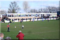
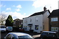
1
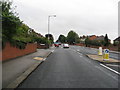
Rotherham - Boswell Street Junction with Broom Road (A6021)
Image: © Alan Heardman
Taken: 9 Sep 2008
0.05 miles
6
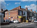
Hair Salon on Badsley Moor Lane, Rotherham
Image: © Neil Theasby
Taken: 16 Aug 2013
0.12 miles
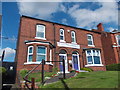
9
Faraday House
This house which is split up into bed sits is on Clifton Crescent North. For a few months in the 1970's the photographer occupied one of the rooms here.
Image: © Nigel Mykura
Taken: 5 Mar 2017
0.19 miles
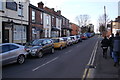
10
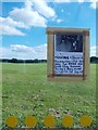
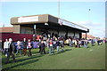
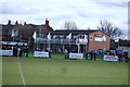
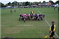
Lost dog notice taped to a bus shelter
In Rotherham - with Herringthorpe Playing Field beyond it.
Image: © Neil Theasby
Taken: 16 Aug 2013
0.21 miles