
IMAGES TAKEN NEAR TO
Prince Street, MEXBOROUGH, S64 8NN
Introduction
This page details the photographs taken nearby to Prince Street, S64 8NN by members of the Geograph project.
The Geograph project started in 2005 with the aim of publishing, organising and preserving representative images for every square kilometre of Great Britain, Ireland and the Isle of Man.

There are currently over 7.5m images from over14,400 individuals and you can help contribute to the project by visiting https://www.geograph.org.uk
Image Map
Images are licensed for reuse under creativecommons.org/licenses/by-sa/2.0
Notes
- Clicking on the map will re-center to the selected point.
- The higher the marker number, the further away the image location is from the centre of the postcode.
Image Listing (13 Images Found)
Images are licensed for reuse under creativecommons.org/licenses/by-sa/2.0
Image
Details
Distance
1
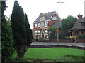
Swinton Carnegie Library
This library has been replaced by a repulsive modern building behind the photographer.
The one in the picture is (I think) converted to flats.
Image: © George Middleton
Taken: 15 Oct 2005
0.18 miles
2
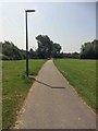
Footpath cycleway to Swinton from Manvers
Used to be just a dirt path.
Image: © Steve Fareham
Taken: 9 Jun 2016
0.21 miles
3
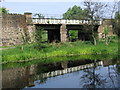
Mexborough - railway bridge over Dearne Canal
Image: © Dave Bevis
Taken: 25 Apr 2011
0.22 miles

6
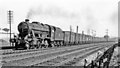
Down empties on the Midland main line near Swinton, 1957
View southward from the path beside the canal, which was convenient for watching trains on the very busy ex-Midland main line between Sheffield and Leeds. The Swinton & Knottingley Joint main line turned off ahead at Wath Road Junction, surviving the closure due to mining subsidence of the direct line to Leeds via Normanton. The signal-box in the distance was for Swinton Junction, where the south-east loop line still connects with the ex-GCR at Mexborough West Junction. The Stanier 8F 2-8-0 is No. 48540, the first built at Darlington Works in 1944, one of several batches built at Railway Shops during the War. It was used on the LNER until 1947, then survived right on until 11/67. The train comprises many ex-NER high-capacity coke wagons.
Image: © Ben Brooksbank
Taken: 17 Jun 1957
0.24 miles
8
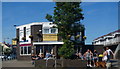
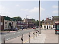
The Butchers Arms Swinton
In the 'new' centre of Swinton near the Library.
Image: © Steve Fareham
Taken: 21 Oct 2007
0.24 miles
9
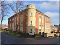
Yorkfield Court
Apartment building on Sidney Street
Image: © Graham Hogg
Taken: 28 Nov 2022
0.24 miles
10
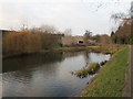
The present end of the Dearne and Dove Canal
This canal linked Barnsley with the River Don. Most of its length has been abandoned but a short section from the River Don to this point remains. https://en.wikipedia.org/wiki/Dearne_and_Dove_Canal
Image: © Jonathan Thacker
Taken: 3 Jan 2019
0.24 miles