
IMAGES TAKEN NEAR TO
Rotary Drive, ROTHERHAM, S63 7FD
Introduction
This page details the photographs taken nearby to Rotary Drive, S63 7FD by members of the Geograph project.
The Geograph project started in 2005 with the aim of publishing, organising and preserving representative images for every square kilometre of Great Britain, Ireland and the Isle of Man.

There are currently over 7.5m images from over14,400 individuals and you can help contribute to the project by visiting https://www.geograph.org.uk
Image Map
Images are licensed for reuse under creativecommons.org/licenses/by-sa/2.0
Notes
- Clicking on the map will re-center to the selected point.
- The higher the marker number, the further away the image location is from the centre of the postcode.
Image Listing (25 Images Found)
Images are licensed for reuse under creativecommons.org/licenses/by-sa/2.0
Image
Details
Distance
1

Ready for blast off?
Piling rig seen from RSPB Old Moor.
Image: © Steve Fareham
Taken: 19 Apr 2013
0.03 miles
2

Rubbish!
Washed down and left after floods. The area behind is the RSPB nature reserve, Old Moor.
Image: © Steve Fareham
Taken: 17 Aug 2007
0.11 miles
3

RSPB Old Moor from Route 62
Looking into the RSPB reserve from National Cycle Network route 62 running along the former Penistone and Doncaster railway line.
Image: © DS Pugh
Taken: 13 Apr 2025
0.11 miles
4

New offices under construction by MSSR.
Image: © Steve Fareham
Taken: 17 Aug 2007
0.12 miles
5
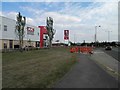
KFC on Manvers Way
One of many new buildings in this former industrial area.
Image: © Steve Fareham
Taken: 31 Jul 2011
0.12 miles
6

Cycle path beside RSPB Old Moor
The path is part of National Cycle Network route 62.
Image: © DS Pugh
Taken: 13 Apr 2025
0.13 miles
7

Path to the south of RSPB Old Moor
The path is part of National Cycle Network route 62.
Image: © DS Pugh
Taken: 13 Apr 2025
0.13 miles
8
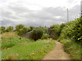
Bird sanctuary bridge over Trans Pennine Trail.
Image: © Steve Fareham
Taken: 17 Aug 2007
0.13 miles
9
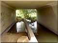
How good is your balance carrying your bike?
Extensive flooding of the Knoll Beck has washed the Trans Pennine Trail away, the water on the trail was 700mm + deep.
Image: © Steve Fareham
Taken: 17 Aug 2007
0.14 miles
10

Old Moor Lane
The entrance road to Old Moor RSPB Nature Reserve.
Image: © Neil Theasby
Taken: 14 Jul 2016
0.15 miles