IMAGES TAKEN NEAR TO
Moorland View, ROTHERHAM, S63 6DH
Introduction
This page details the photographs taken nearby to Moorland View, S63 6DH by members of the Geograph project.
The Geograph project started in 2005 with the aim of publishing, organising and preserving representative images for every square kilometre of Great Britain, Ireland and the Isle of Man.

There are currently over 7.5m images from over14,400 individuals and you can help contribute to the project by visiting https://www.geograph.org.uk
Image Map
Images are licensed for reuse under creativecommons.org/licenses/by-sa/2.0
Notes
- Clicking on the map will re-center to the selected point.
- The higher the marker number, the further away the image location is from the centre of the postcode.
Image Listing (17 Images Found)
Images are licensed for reuse under creativecommons.org/licenses/by-sa/2.0
Image
Details
Distance
1

West Melton
Looking eastwards from West Melton, South Yorkshire, towards Wath upon Dearne Church.
Image: © Martin Clark
Taken: Unknown
0.15 miles
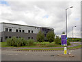
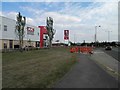
2
New offices under construction by MSSR.
Image: © Steve Fareham
Taken: 17 Aug 2007
0.15 miles

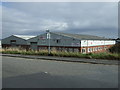
4

Derwent Way
Industrial estate road off Barnsley Road.
Image: © JThomas
Taken: 27 Sep 2014
0.18 miles
7

Ready for blast off?
Piling rig seen from RSPB Old Moor.
Image: © Steve Fareham
Taken: 19 Apr 2013
0.18 miles
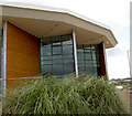
8
KFC on Manvers Way
One of many new buildings in this former industrial area.
Image: © Steve Fareham
Taken: 31 Jul 2011
0.18 miles
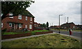
9

Burns Way
1950s council houses in West Melton.
Image: © Burgess Von Thunen
Taken: 27 Feb 2013
0.20 miles