IMAGES TAKEN NEAR TO
Blackamoor Road, ROTHERHAM, S62 7SP
Introduction
This page details the photographs taken nearby to Blackamoor Road, S62 7SP by members of the Geograph project.
The Geograph project started in 2005 with the aim of publishing, organising and preserving representative images for every square kilometre of Great Britain, Ireland and the Isle of Man.

There are currently over 7.5m images from over14,400 individuals and you can help contribute to the project by visiting https://www.geograph.org.uk
Image Map
Images are licensed for reuse under creativecommons.org/licenses/by-sa/2.0
Notes
- Clicking on the map will re-center to the selected point.
- The higher the marker number, the further away the image location is from the centre of the postcode.
Image Listing (11 Images Found)
Images are licensed for reuse under creativecommons.org/licenses/by-sa/2.0
Image
Details
Distance
1
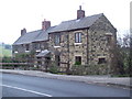
Blackamore
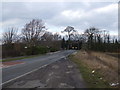
These four cottages stand alone on Blackamore Road, Swinton (B6092). There is a Blackamore Inn Plantation behind the camera but there is no evidence of an inn anywhere near.
Image: © George Middleton
Taken: 22 Nov 2005
0.00 miles
4
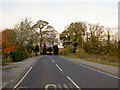
Blackamoor Road
Heading towards Swinton the Woodman roundabout.
Image: © Steve Fareham
Taken: 3 Nov 2007
0.02 miles
5
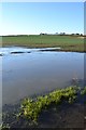
View to Wentworth Road from Blackamoor
Across the flooded corner of an arable field.
Image: © Neil Theasby
Taken: 5 Dec 2012
0.05 miles
6
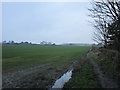
Footpath off Blackamoor Road
Leads to Abdy.
Image: © Jonathan Thacker
Taken: 19 Jan 2019
0.06 miles
7
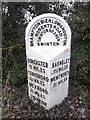
Old milestone
This West Riding CC milestone dating from 1893/94 is on the B6092 near Abdy Lane which leads to Wath Golf Course.. In the contract awarded to Gill & Frank Stead, stonemasons, of Mirfield to erect 615 WRCC milestones, six were specified for this route. This was the first, the next three are now missing with Wentworth 7½ & 8½ still in place. When the castings were made at the Brayshaw & Booth foundry in Liversedge they had a lot of information to inlude. The mileage to Swinton hidden in the dead leaves is 1½ miles. It is Grade II listed 1132778.
Image: © Chris Minto
Taken: 11 Mar 2018
0.13 miles
8
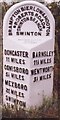
Old Milestone, B6092, Blackamoor Road
45m SW of junction with Abdy Lane (Wath Golf Course). Located on the West side of road, on grass verge. Metal plate attached to stone post, Brayshaw & Booth casting design, 19th century.
Inscription reads: DONCASTER / 11 MILES / CONISBORO / 5½ MILES / MEXBORO / 2¾ MILES / SWINTON / 1½ MILES // BARNSLEY / 11¼ MILES / WENTWORTH / 3½ MILES // BRAMPTON BIERLOW & HOOTON / ROBERTS ROAD / SWINTON BRANCH / SWINTON // BRAYSHAW & BOOTH / MAKERS / LIVERSEDGE
Grade II listed by Historic England. see https://historicengland.org.uk/listing/the-list/list-entry/1132778
Milestone Society National ID: YS_WWSW03
Image: © Christine Minto
Taken: 2 Jan 2006
0.14 miles