IMAGES TAKEN NEAR TO
Blyth Avenue, ROTHERHAM, S62 7AU
Introduction
This page details the photographs taken nearby to Blyth Avenue, S62 7AU by members of the Geograph project.
The Geograph project started in 2005 with the aim of publishing, organising and preserving representative images for every square kilometre of Great Britain, Ireland and the Isle of Man.

There are currently over 7.5m images from over14,400 individuals and you can help contribute to the project by visiting https://www.geograph.org.uk
Image Map
Images are licensed for reuse under creativecommons.org/licenses/by-sa/2.0
Notes
- Clicking on the map will re-center to the selected point.
- The higher the marker number, the further away the image location is from the centre of the postcode.
Image Listing (25 Images Found)
Images are licensed for reuse under creativecommons.org/licenses/by-sa/2.0
Image
Details
Distance
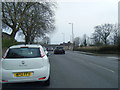
5

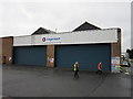
Stagecoach Rawmarsh Bus Depot on Dale Road
Image: © Graham Hogg
Taken: 13 Mar 2018
0.16 miles
6
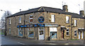
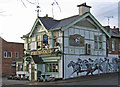
Rawmarsh - Dale Road Fish Bar
Stone inscription says "Sycamore Buildings 1872".
Image: © Dave Bevis
Taken: 7 Dec 2013
0.17 miles
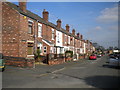
8
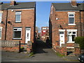
Terraced houses on Quarry Street, Rawmarsh
Image: © Neil Theasby
Taken: 5 Dec 2012
0.17 miles
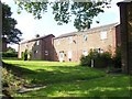
10
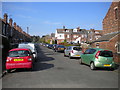
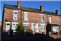
Park Street, Rawmarsh
Leading to Victoria Park.
Image: © Richard Vince
Taken: 30 Mar 2019
0.17 miles