IMAGES TAKEN NEAR TO
Greasbrough Road, ROTHERHAM, S61 4QL
Introduction
This page details the photographs taken nearby to Greasbrough Road, S61 4QL by members of the Geograph project.
The Geograph project started in 2005 with the aim of publishing, organising and preserving representative images for every square kilometre of Great Britain, Ireland and the Isle of Man.

There are currently over 7.5m images from over14,400 individuals and you can help contribute to the project by visiting https://www.geograph.org.uk
Image Map
Images are licensed for reuse under creativecommons.org/licenses/by-sa/2.0
Notes
- Clicking on the map will re-center to the selected point.
- The higher the marker number, the further away the image location is from the centre of the postcode.
Image Listing (11 Images Found)
Images are licensed for reuse under creativecommons.org/licenses/by-sa/2.0
Image
Details
Distance
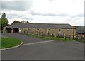
2
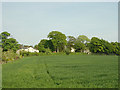
Barbot Old Hall Farm
The farm buildings are being converted for residential accommodation.
Image: © Alan Murray-Rust
Taken: 11 May 2008
0.03 miles
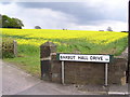
3
B6089 Car Hill at Barbot Hill Road junction
Image: © Colin Pyle
Taken: 7 Apr 2019
0.04 miles
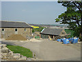
4
Barbot Old Hall Farm
In the foreground. Barbot Hall itself is hidden in the clump of trees.
Image: © Alan Murray-Rust
Taken: 11 May 2008
0.06 miles
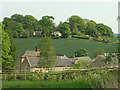
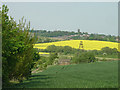
5
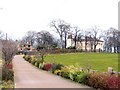
Barbot Hall
Impressive country houses at Barbot Hall on the B6089 south of Greasbrough
Image: © Roger May
Taken: 19 Mar 2006
0.08 miles
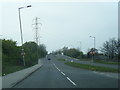
6
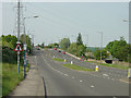
Car Hill
This is the B6089 to Barnsley between Rotherham and Greasbrough
Image: © Alan Murray-Rust
Taken: 11 May 2008
0.09 miles
8
Barbot Hall
The Hall itself is largely concealed by the trees, mid right.
Image: © Alan Murray-Rust
Taken: 11 May 2008
0.11 miles
9
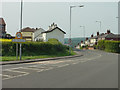
The entry to Greasbrough
The B6089 narrows from a dual carriageway and turns sharply downhill into Greasbrough
Image: © Alan Murray-Rust
Taken: 11 May 2008
0.12 miles
10
View from Car Hill
Looking across to Rawmarsh. The hut and lattice structure are a pumping station.
Image: © Alan Murray-Rust
Taken: 11 May 2008
0.18 miles