IMAGES TAKEN NEAR TO
Scrooby Street, ROTHERHAM, S61 4PF

Introduction

This page details the photographs taken nearby to Scrooby Street, S61 4PF by members of the Geograph project.

The Geograph project started in 2005 with the aim of publishing, organising and preserving representative images for every square kilometre of Great Britain, Ireland and the Isle of Man.

There are currently over 7.5m images from over14,400 individuals and you can help contribute to the project by visiting https://www.geograph.org.uk

Image Map


Images are licensed for reuse under creativecommons.org/licenses/by-sa/2.0
Notes
  • Clicking on the map will re-center to the selected point.
  • The higher the marker number, the further away the image location is from the centre of the postcode.

Image Listing (11 Images Found)

Images are licensed for reuse under creativecommons.org/licenses/by-sa/2.0
Image
Details
Distance
1
Scrooby Street
Image: © Martin Speck Taken: 3 May 2010
0.03 miles
2
Looking over Greasbrough
From a hilly section of the Rotherham Round Walk to the west of Rawmarsh
Image: © Graham Hogg Taken: 13 Mar 2018
0.07 miles
3
Scrooby Drive, Greasbrough
Image: © Alex McGregor Taken: 8 Feb 2011
0.08 miles
4
Greasbrough Post Office
Situated on Cross South Street.
Image: © Jonathan Clitheroe Taken: 10 Aug 2016
0.16 miles
5
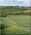
Farmland near Greasbrough
Fields at the edge of town, looking towards Rawmarsh. The tower of St Mary (Image]) is roughly central.
Image: © Stephen Richards Taken: 11 May 2013
0.17 miles
6
Scrooby Lane, Greasbrough
Maps give no indication that this lane is one way (except for cycles). A considerable detour is need to make the journey in the opposite direction.
Image: © Alan Murray-Rust Taken: 11 May 2008
0.17 miles
7
Glossop Lodge
Image: © John Slater Taken: 7 Nov 2013
0.20 miles
8
Greasbrough from The Tops
Greasbrough has developed from a separate village into an outlying suburb of Rotherham
Image: © Alan Murray-Rust Taken: 11 May 2008
0.20 miles
9
Rape crops from Scrooby Lane
Looking across the valley of the Cinder Brook to The Tops
Image: © Alan Murray-Rust Taken: 11 May 2008
0.22 miles
10
The entry to Greasbrough
The B6089 narrows from a dual carriageway and turns sharply downhill into Greasbrough
Image: © Alan Murray-Rust Taken: 11 May 2008
0.22 miles