
IMAGES TAKEN NEAR TO
Maxwell Street, SHEFFIELD, S4 7JN
Introduction
This page details the photographs taken nearby to Maxwell Street, S4 7JN by members of the Geograph project.
The Geograph project started in 2005 with the aim of publishing, organising and preserving representative images for every square kilometre of Great Britain, Ireland and the Isle of Man.

There are currently over 7.5m images from over14,400 individuals and you can help contribute to the project by visiting https://www.geograph.org.uk
Image Map
Images are licensed for reuse under creativecommons.org/licenses/by-sa/2.0
Notes
- Clicking on the map will re-center to the selected point.
- The higher the marker number, the further away the image location is from the centre of the postcode.
Image Listing (33 Images Found)
Images are licensed for reuse under creativecommons.org/licenses/by-sa/2.0
Image
Details
Distance
2
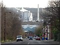
Looking down Sutherland Road, Sheffield
With a good view of Veolia's Energy Recovery Facility.
Image: © Neil Theasby
Taken: 8 Jan 2016
0.06 miles
3
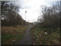
Path to East Earsham Street
Old maps show this area as being built-up.
Image: © Jonathan Thacker
Taken: 15 Dec 2012
0.07 miles
4
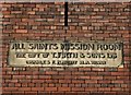
Plaque on the former All Saints Mission Room
On Forncett Street, just down the hill from the site of All Saints Church which was demolished in the nineteen seventies. Most of the humble houses that once stood in this area were demolished long ago and the mission room no longer serves its original purpose. Now it is an industrial unit.
Image: © Neil Theasby
Taken: 8 Jan 2016
0.10 miles
5
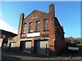
All Saints Mission Room on Forncett Road, Burngreave
The stone plaque under the apex of the building's frontage tells passers-by that the building was given to the local community by steel manufacturing company T.Firth and Sons Ltd.. That must have been in the days when there was a community hereabouts. Most of the neighbouring houses were demolished long ago and the mission room was converted to industrial premises.
Image: © Neil Theasby
Taken: 8 Jan 2016
0.10 miles
6
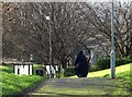
Woman on a path at Burngreave
This area of Sheffield is perhaps the most ethnically diverse so it was no surprise to see a Muslim woman walking home through Ellesmere Park.
Image: © Neil Theasby
Taken: 8 Jan 2016
0.11 miles
7
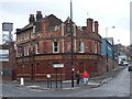
Club Xes at the former Norfolk Arms Hotel, Burngreave
Image: © JThomas
Taken: 17 Feb 2012
0.12 miles
8
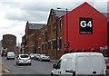
Red gable end
Drive down Carlisle Street towards town, you can't miss us. A Business Centre.
Image: © Peter Barr
Taken: 13 Jul 2011
0.12 miles
9
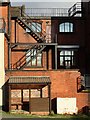
Rear of industrial premises - Carlisle St, Sheffield
The shelter at ground level is for smokers - an architectural trend that may be overlooked by history.
Image: © Neil Theasby
Taken: 8 Jan 2016
0.12 miles
10
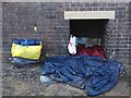
Homeless man's nest
On Forncett Street, Sheffield. A rather unusual bolt hole for a homeless person situated as it is in an industrial zone which must be rather lonesome and eerie at night-time.
Image: © Neil Theasby
Taken: 8 Jan 2016
0.12 miles