
IMAGES TAKEN NEAR TO
Old Hall Close, CHESTERFIELD, S45 8JD
Introduction
This page details the photographs taken nearby to Old Hall Close, S45 8JD by members of the Geograph project.
The Geograph project started in 2005 with the aim of publishing, organising and preserving representative images for every square kilometre of Great Britain, Ireland and the Isle of Man.

There are currently over 7.5m images from over14,400 individuals and you can help contribute to the project by visiting https://www.geograph.org.uk
Image Map
Images are licensed for reuse under creativecommons.org/licenses/by-sa/2.0
Notes
- Clicking on the map will re-center to the selected point.
- The higher the marker number, the further away the image location is from the centre of the postcode.
Image Listing (107 Images Found)
Images are licensed for reuse under creativecommons.org/licenses/by-sa/2.0
Image
Details
Distance
1
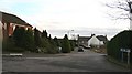
Old Hall Close
Image from its junction with Back Lane Image
The junction in the middle distance (right) is with Image
The building with the white gable end is ‘Old Whitehall’. In front of this building is a right of way that leads past Image to Image at its junction with Image
Image: © Alan Walker
Taken: 12 Jan 2007
0.02 miles
2
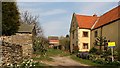
Barlow Bank Farm
Although now just a private dwelling, the house on the right (for sale at the time this photograph was taken) is still called Barlow Bank Farm.
The photograph was taken from the western end of Image (to the left) at its junction with Image (behind the viewpoint).
Ahead (north-easterly, leading toward the modern house) is a Image leading to Image
Image: © Alan Walker
Taken: 2 Apr 2007
0.03 miles
3
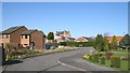
Old Hall Close
The cul-de-sac, Old Hall Close, photographed from near its southern end.
The junction in the middle distance (left) is with Image
The northern end of Image joins Image ahead (but out of shot).
Just past the shadow, on the near left, is a Image
Image: © Alan Walker
Taken: 5 Apr 2007
0.03 miles
4
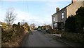
Back Lane
Ahead Back Lane leads (just after the parked car) to a small housing development Image built in the 1980’s, thence to Whitehall Farm Image before passing the entrance miners once used to the local colliery before the lanes junction with Slack’s Lane Image
Behind the viewpoint is a short slope leading to the lane's junction with Bridge Street Image
Image: © Alan Walker
Taken: 12 Jan 2007
0.03 miles
5
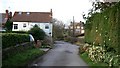
Back Lane
The photograph shows Back Lane looking toward Image (seen over the hedges in the distance). From where the lane turns to the left there is a track that leads to the farm yard. This track is shared by a footpath to Image
The houses to the left of the picture have suffered from mining subsidence at some point in their history as evidenced by the obvious angle between the tops of the windows and the slope of the roof. Back Lane turns sharply to the left just after these houses Image
Just passed the hedge on the right is a track that was once the entrance the miners used to access the local colliery Image
Behind the viewpoint is the lanes junction with Slack’s Lane Image
Image: © Alan Walker
Taken: 12 Jan 2007
0.03 miles
6
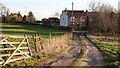
Whitehall Farm
The photograph shows the short track (shared by a public footpath) from the farmyard at Whitehall Farm to Image
Toward the left of the picture Image has a junction with Image
To the right Image continues toward its junction with Image
To see a photograph from the other end of the lane but looking back (northerly), toward this viewpoint, click here, Image
Image: © Alan Walker
Taken: 14 Feb 2007
0.03 miles
7
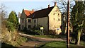
Barlow Bank Farm
Prior to 1800, Pilsley was purely an agricultural settlement and at that time it consisted of Upper Pilsley and Nether Pilsley. Few of the houses from that period still exist though Barlow Bank Farm (no longer a farm building) is one of them.
The building is situated near to the junction of Slack’s Lane (seen on the right of the photograph Image) and the northern end of Bridge Street Image
Image: © Alan Walker
Taken: 10 Jan 2007
0.04 miles
8
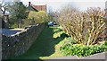
Right of Way
This right of way connects Image (behind the viewpoint) Image at its junction with Image
The building with the tiled roof is Image
Image: © Alan Walker
Taken: 5 Apr 2007
0.05 miles
9
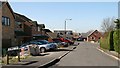
Granby Close
The cul-de-sac, Granby Close from its junction with Image
Image: © Alan Walker
Taken: 5 Apr 2007
0.05 miles
10
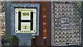
Fire hydrant and signage
This Fire hydrant and its signage are on Slack’s Lane roughly half way between its junction with Forrest Drive and where it meets The Paddocks Image and Back Lane Image
Image: © Alan Walker
Taken: 10 Jan 2007
0.05 miles