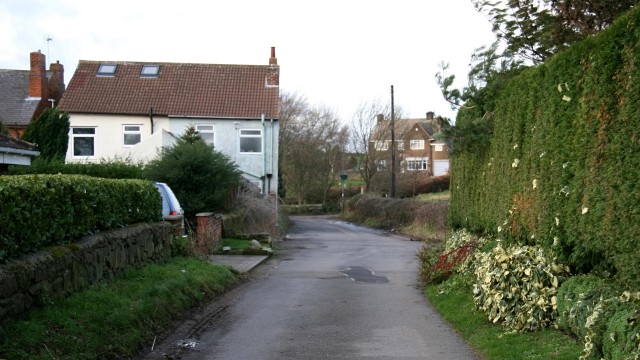
Back Lane
Introduction
The photograph on this page of Back Lane by Alan Walker as part of the Geograph project.
The Geograph project started in 2005 with the aim of publishing, organising and preserving representative images for every square kilometre of Great Britain, Ireland and the Isle of Man.
There are currently over 7.5m images from over 14,400 individuals and you can help contribute to the project by visiting https://www.geograph.org.uk

Image: © Alan Walker Taken: 12 Jan 2007
The photograph shows Back Lane looking toward Image (seen over the hedges in the distance). From where the lane turns to the left there is a track that leads to the farm yard. This track is shared by a footpath to Image The houses to the left of the picture have suffered from mining subsidence at some point in their history as evidenced by the obvious angle between the tops of the windows and the slope of the roof. Back Lane turns sharply to the left just after these houses Image Just passed the hedge on the right is a track that was once the entrance the miners used to access the local colliery Image Behind the viewpoint is the lanes junction with Slack’s Lane Image

