
IMAGES TAKEN NEAR TO
Dale View Road, CHESTERFIELD, S45 8DR
Introduction
This page details the photographs taken nearby to Dale View Road, S45 8DR by members of the Geograph project.
The Geograph project started in 2005 with the aim of publishing, organising and preserving representative images for every square kilometre of Great Britain, Ireland and the Isle of Man.

There are currently over 7.5m images from over14,400 individuals and you can help contribute to the project by visiting https://www.geograph.org.uk
Image Map
Images are licensed for reuse under creativecommons.org/licenses/by-sa/2.0
Notes
- Clicking on the map will re-center to the selected point.
- The higher the marker number, the further away the image location is from the centre of the postcode.
Image Listing (67 Images Found)
Images are licensed for reuse under creativecommons.org/licenses/by-sa/2.0
Image
Details
Distance
1
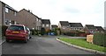
Valley Close
Valley Close, Lower Pilsley.
Behind the viewpoint and to the right (northerly) is the close’s junction with Image
For a more north-easterly (behind the viewpoint) photograph of Valley Close, click here Image
Image: © Alan Walker
Taken: 28 Feb 2007
0.03 miles
2
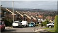
Dale View Road
The photograph shows the cul-de-sac, Dale View Road, near its closed end.
The housing in the middle distance (north-westerly, over the rooftops) is part of North Wingfield http://en.wikipedia.org/wiki/North_Wingfield .
A few metres behind the viewpoint is the road’s junction with Image
For a more north-easterly (behind the viewpoint, right) photograph of Dale View Road, from its junction with Image, click here Image
Image: © Alan Walker
Taken: 28 Feb 2007
0.03 miles
3
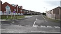
Dale View Road
Dale View Road, Lower Pilsley from its junction with Image Ahead and then bearing right Image ‘drops’ down hill to end in a cul-de-sac. As it turns to the right (north-west), another cul-de-sac, Image joins from the left (south-west).
The blocks of flats (left) are a development called 'Image'
To the left (easterly) Image continues to its junction with Image and thence on toward Waterloo and its junction with Locko Lane.
To the right (westerly) Image continues toward its junction with Image and thence to Image at Pilsley Green.
See also this photograph by Alan Heardman, Image
Image: © Alan Walker
Taken: 28 Feb 2007
0.03 miles
4
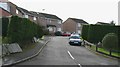
Valley Close
The cul-de-sac, Valley Close, Lower Pilsley from its junction with Image
For a more south-westerly (ahead) photograph of Valley Close, click here Image
To the right (easterly) Locko Road continues toward Waterloo and its junction with Locko Lane.
To the left Locko Road continues toward a Image at Pilsley Green, Lower Pilsley.
Image: © Alan Walker
Taken: 28 Feb 2007
0.04 miles
5
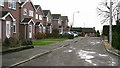
Dale View Close
Dale View Close, Lower Pilsley, is a cul-de-sac off Image (behind and right of the viewpoint).
The, part seen, house ahead is on Rupert Street although there is no junction ahead (as testified by the three bollards).
(This section of the close does not appear on the OS map.)
Image: © Alan Walker
Taken: 28 Feb 2007
0.06 miles
6

Locko Road
The photograph shows the western end of Locko Road and was taken from a point close to its Image (behind the viewpoint) with Image, Lower Pilsley.
On the day this photograph was taken and walking along the left-hand footpath until the first, small field was reached, there was these Image
For a photograph of Locko Road taken from near the grass on the right but looking back, toward this viewpoint, click here Image
Ahead the road continues toward Waterloo and its junction with Locko Lane.
For a more easterly (ahead) view of Locko Road, click here Image
Image: © Alan Walker
Taken: 2 Mar 2007
0.07 miles
7
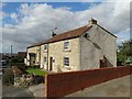
Cottages at Lower Pilsley
Opposite the primary school.
Image: © Neil Theasby
Taken: 25 Sep 2015
0.07 miles
8
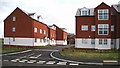
Pilsley Dale
The blocks of flats in this photograph are a development called 'Pilsley Dale' and are on the junction of Image with Image
Image: © Alan Walker
Taken: 28 Feb 2007
0.07 miles
9
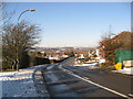
Lower Pilsley - Rupert Street
Parkhouse School can be seen (centre picture) at the bottom of the hill.
Image: © Alan Heardman
Taken: 10 Feb 2009
0.07 miles
10
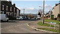
Junction
The photograph shows Rupert Street (looking in a northerly direction toward Parkhouse Green) at its junction with Image
To see a more northerly (ahead) photograph of Rupert Street, click here Image
To see a more southerly (some 75metres behind the viewpoint) photograph of Rupert Street, click here, Image
Image: © Alan Walker
Taken: 26 Feb 2007
0.08 miles