IMAGES TAKEN NEAR TO
Elm Tree Close, CHESTERFIELD, S44 6RW
Introduction
This page details the photographs taken nearby to Elm Tree Close, S44 6RW by members of the Geograph project.
The Geograph project started in 2005 with the aim of publishing, organising and preserving representative images for every square kilometre of Great Britain, Ireland and the Isle of Man.

There are currently over 7.5m images from over14,400 individuals and you can help contribute to the project by visiting https://www.geograph.org.uk
Image Map
Images are licensed for reuse under creativecommons.org/licenses/by-sa/2.0
Notes
- Clicking on the map will re-center to the selected point.
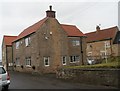
- The higher the marker number, the further away the image location is from the centre of the postcode.
Image Listing (52 Images Found)
Images are licensed for reuse under creativecommons.org/licenses/by-sa/2.0
Image
Details
Distance
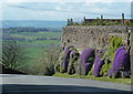
4
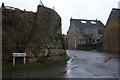
Southwest corner of Palterton Main Street
A high wall built out of the rock at the top of the hillside is a feature at the corner of Main Street, at the top of Rylah Hill.
Image: © Andrew Hill
Taken: 1 Jan 2011
0.04 miles
5
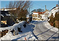
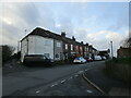
Main Street, Palterton
A very wintry looking village scene. The lane runs along the edge of the hillside overlooking the Doe Lea Valley, seen from the top of Rylah Hill.
Image: © Andrew Hill
Taken: 5 Dec 2010
0.05 miles
8
Lane and wall at the top of the hill, Palterton
Palterton is on the edge of the plateau. This high wall is a feature at the lane junction at the top of Rylah Hill. Aubrieta in flower along the wall.
Image: © Andrew Hill
Taken: 21 Apr 2012
0.05 miles
9
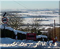
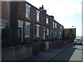
Road closed - top of Rylah Hill, Palterton
Rylah Hill drops steeply into the Doe Lea Valley, and had been closed for a few days following heavy snow, although it was passable for 4-wheel drive vehicles.
Image: © Andrew Hill
Taken: 5 Dec 2010
0.06 miles
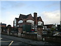
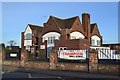
10
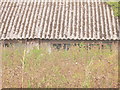
Old barn in Palterton.
Alongside an overgrown footpath.
Image: © steven ruffles
Taken: 20 Sep 2020
0.06 miles