
IMAGES TAKEN NEAR TO
Riverside Way, CHESTERFIELD, S44 6GA
Introduction
This page details the photographs taken nearby to Riverside Way, S44 6GA by members of the Geograph project.
The Geograph project started in 2005 with the aim of publishing, organising and preserving representative images for every square kilometre of Great Britain, Ireland and the Isle of Man.

There are currently over 7.5m images from over14,400 individuals and you can help contribute to the project by visiting https://www.geograph.org.uk
Image Map
Images are licensed for reuse under creativecommons.org/licenses/by-sa/2.0
Notes
- Clicking on the map will re-center to the selected point.
- The higher the marker number, the further away the image location is from the centre of the postcode.
Image Listing (72 Images Found)
Images are licensed for reuse under creativecommons.org/licenses/by-sa/2.0
Image
Details
Distance
1
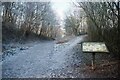
The Stockley Trail near Peter Fidler Nature Reserve
Image: © David Lally
Taken: 21 Jan 2023
0.04 miles
2
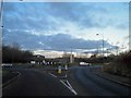
Roundabout on the A632 from Riverside Way
Image: © Steve Fareham
Taken: 11 Dec 2012
0.08 miles
3
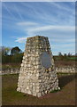
Peter Fidler memorial
A large cairn after the style of an existing memorial to Peter Fidler in Canada. He was born in Bolsover and became chief surveyor for the Hudson Bay Company in Canada where he is held in high regard. The surrounding nature reserve on former coal mining ground is named after him.
Image: © Andrew Hill
Taken: 30 Oct 2010
0.08 miles
4
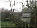
The Stockley Trail
Along the old railway line.
Image: © steven ruffles
Taken: 29 Feb 2020
0.08 miles
5
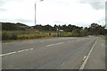
Station Road Bus Stop
The view on the A632 at Bolsover.
Image: © Gordon Griffiths
Taken: 20 Sep 2013
0.10 miles
6
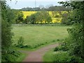
Footpath, Peter Fidler reserve
The path leaves a wooded area to open ground with farmland beyond.
Image: © Andrew Hill
Taken: 8 May 2014
0.10 miles
7
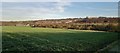
Searching for the path across the newly planted brassica
Bolsover Castle clearly visible on horizon, but no trace of the path. Carr Vale Nature Reserve beyond the field.
Image: © Chris Morgan
Taken: 17 Dec 2013
0.11 miles
8
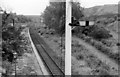
Bolsover (Midland) Station (remains)
View southward, towards Pleasley and Mansfield; ex-Midland Mansfield - Pleasley - Staveley - Chesterfield line. Station closed 28/7/30 to passengers (excursions until 1939), to goods 1/11/62, but was reopened 28/7/77 - 1981! The line continued to carry colliery traffic until fairly recently and it is shown on the modern map as 'disused'. What is the present situation?
Image: © Ben Brooksbank
Taken: 13 Jul 1963
0.11 miles
9
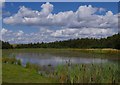
Lake, Peter Fidler nature reserve
A lake on a hill - the reserve is in a former mining area, and the reserves have been developed to transform the landscape in this section of the Doe Lea valley below the town of Bolsover.
Image: © Andrew Hill
Taken: 9 Aug 2014
0.12 miles
10

Plaque on the Peter Fidler Memorial Cairn
Image: © Graham Hogg
Taken: 17 Dec 2013
0.12 miles