Bolsover (Midland) Station (remains)
Introduction
The photograph on this page of Bolsover (Midland) Station (remains) by Ben Brooksbank as part of the Geograph project.
The Geograph project started in 2005 with the aim of publishing, organising and preserving representative images for every square kilometre of Great Britain, Ireland and the Isle of Man.

There are currently over 7.5m images from over 14,400 individuals and you can help contribute to the project by visiting https://www.geograph.org.uk
Bolsover (Midland) Station (remains)
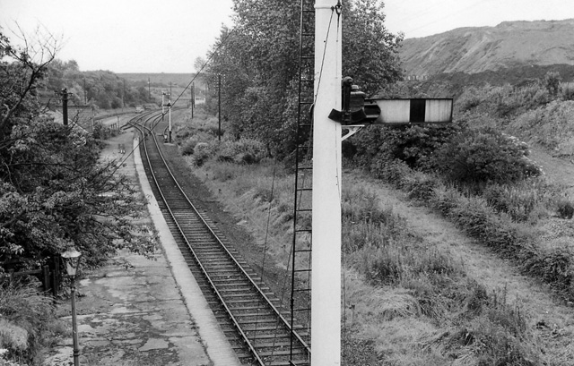
Image: © Ben Brooksbank Taken: 13 Jul 1963
View southward, towards Pleasley and Mansfield; ex-Midland Mansfield - Pleasley - Staveley - Chesterfield line. Station closed 28/7/30 to passengers (excursions until 1939), to goods 1/11/62, but was reopened 28/7/77 - 1981! The line continued to carry colliery traffic until fairly recently and it is shown on the modern map as 'disused'. What is the present situation?
Images are licensed for reuse under creativecommons.org/licenses/by-sa/2.0
Image Location
Latitude
53.231601
Longitude
-1.308447