
IMAGES TAKEN NEAR TO
Wellington Street, CHESTERFIELD, S43 2BJ
Introduction
This page details the photographs taken nearby to Wellington Street, S43 2BJ by members of the Geograph project.
The Geograph project started in 2005 with the aim of publishing, organising and preserving representative images for every square kilometre of Great Britain, Ireland and the Isle of Man.

There are currently over 7.5m images from over14,400 individuals and you can help contribute to the project by visiting https://www.geograph.org.uk
Image Map
Images are licensed for reuse under creativecommons.org/licenses/by-sa/2.0
Notes
- Clicking on the map will re-center to the selected point.
- The higher the marker number, the further away the image location is from the centre of the postcode.
Image Listing (35 Images Found)
Images are licensed for reuse under creativecommons.org/licenses/by-sa/2.0
Image
Details
Distance
1
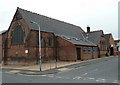
Church of St Barnabas, New Whittington
The church opened as a mission church in 1884 and became a parish church in its own right in 1927 (Church of England website details). It is on the corner of Albert Road and Wellington Street.
Image: © Andrew Hill
Taken: 10 Jun 2011
0.04 miles
2
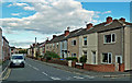
Devonshire Road North
Terraced housing in New Whittington.
Image: © Mary and Angus Hogg
Taken: 6 Sep 2019
0.06 miles
3
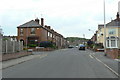
Devonshire Avenue North
Looking north from below the crossing with Devonshire Road North. The road naming in this part of New Whittington is a bit mysterious. These two streets, together with the adjacent South Street North all imply that there is a 'South' version as well. However, none of the 'companion' streets exist, nor is there any obvious area where they could have been built.
Image: © Alan Murray-Rust
Taken: 18 May 2010
0.06 miles
5
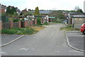
The back of Wellington Street
Apparently just a straightforward 'back' lane for the streets on either side, this has a much more interesting history. It is in fact the line of the tramroad which connected the ironstone mines on Glasshouse Common with the Chesterfield Canal at Dixon's Wharf.
Image: © Alan Murray-Rust
Taken: 18 May 2010
0.08 miles
6
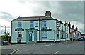
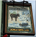
The Forge
A free house on the corner of Station Lane in New Whittington.
Image: © Mary and Angus Hogg
Taken: 6 Sep 2019
0.08 miles
7
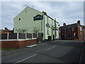
The Forge Inn, New Whittington
On Station Lane.
Image: © JThomas
Taken: 7 Mar 2015
0.09 miles
8
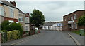
South Street North, New Whittington
A mix of houses and industry at the lower end of the street away from the centre of New Whittington.
Image: © Andrew Hill
Taken: 10 Jun 2011
0.12 miles
9
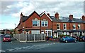
Houses in New Whittington
Viewed just inside the square.
Image: © Mary and Angus Hogg
Taken: 6 Sep 2019
0.14 miles
10
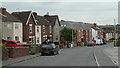
Wellington Street, New Whittington
Looking down a residential street. New houses have just been built as infill for a space formerly occupied by a chapel.
Image: © Andrew Hill
Taken: 10 Jun 2011
0.15 miles