
IMAGES TAKEN NEAR TO
Brookfield Close, CHESTERFIELD, S42 5FJ
Introduction
This page details the photographs taken nearby to Brookfield Close, S42 5FJ by members of the Geograph project.
The Geograph project started in 2005 with the aim of publishing, organising and preserving representative images for every square kilometre of Great Britain, Ireland and the Isle of Man.

There are currently over 7.5m images from over14,400 individuals and you can help contribute to the project by visiting https://www.geograph.org.uk
Image Map
Images are licensed for reuse under creativecommons.org/licenses/by-sa/2.0
Notes
- Clicking on the map will re-center to the selected point.
- The higher the marker number, the further away the image location is from the centre of the postcode.
Image Listing (38 Images Found)
Images are licensed for reuse under creativecommons.org/licenses/by-sa/2.0
Image
Details
Distance
1
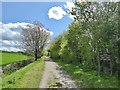
On track entering Grassmoor Country Park
Amazing to see how the old mine sites have been transformed.
Image: © Chris Morgan
Taken: 29 Apr 2015
0.04 miles
2
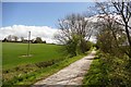
On the Five Pits Trail
The Five Pits Trail is a network of surfaced tracks for recreational use which mostly follows the route of the Great Central Railway. It connects the former collieries of Grassmoor, Williamthorpe, Holmewood, Pilsley and Tibshelf.
Image: © Graham Hogg
Taken: 29 Apr 2015
0.05 miles
4
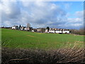
Grassmoor - Birkin Lane from Five Pits Trail
Image: © Alan Heardman
Taken: 20 Jan 2007
0.10 miles
5
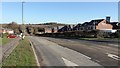
Birkin Lane
A walk around Grassmoor
Image : Previous - (10 of 51) - Next : Image
Looking in a north-easterly direction the photograph shows a new housing development on Birkin Lane. Ahead, the Lane rises to cross a bridge over the Five Pits Trail https://www.derbyshire.gov.uk/images/5%20Pits%20lft%20Jan%202014%20web_tcm44-216030.pdf .
Just beyond the vehicle driving down the lane, on the left, there is an access point to Grassmoor Country Park https://www.derbyshire.gov.uk/images/Grassmoor%20Country%20Park_tcm44-194014.pdf .
Image: © Alan Walker
Taken: 7 Feb 2018
0.10 miles
6
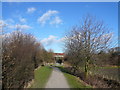
Grassmoor - Birkin Lane Road Bridge
Viewed from Five Pits Trail. This is the point where the trail enters Grassmoor Country Park.
Image: © Alan Heardman
Taken: 20 Jan 2007
0.13 miles
7
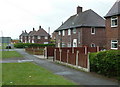
Houses on Birkin Lane, Grassmoor
Near the roundabout at the junction with North Wingfield Road.
Image: © Andrew Hill
Taken: 23 May 2011
0.14 miles
8
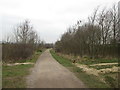
Five Pits Trail near Lings Farm, Grassmoor
Image: © John Slater
Taken: 22 Mar 2016
0.15 miles
9
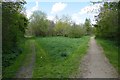
Path junction in Grassmoor Country Park
Reclaimed from the former Grassmoor Colliery, the park lies at the northern end of the Five Pits Trail. The Trail is a network of surfaced tracks for recreational use which mostly follows the route of the Great Central Railway. It connects the former collieries of Grassmoor, Williamthorpe, Holmewood, Pilsley and Tibshelf.
Image: © Graham Hogg
Taken: 29 Apr 2015
0.15 miles
10
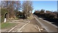
Birkin Lane
A walk around Grassmoor
Image : Previous - (9 of 51) - Next : Image
Looking in a north-easterly direction the photograph shows Birkin Lane at a point where the Lane rises to cross a bridge over the Five Pits Trail https://www.derbyshire.gov.uk/images/5%20Pits%20lft%20Jan%202014%20web_tcm44-216030.pdf and, to the left, there is an access point to Grassmoor Country Park https://www.derbyshire.gov.uk/images/Grassmoor%20Country%20Park_tcm44-194014.pdf .
See also this photograph by Chris Morgan:- Image
Image: © Alan Walker
Taken: 7 Feb 2018
0.15 miles