Birkin Lane
Introduction
The photograph on this page of Birkin Lane by Alan Walker as part of the Geograph project.
The Geograph project started in 2005 with the aim of publishing, organising and preserving representative images for every square kilometre of Great Britain, Ireland and the Isle of Man.

There are currently over 7.5m images from over 14,400 individuals and you can help contribute to the project by visiting https://www.geograph.org.uk
Birkin Lane
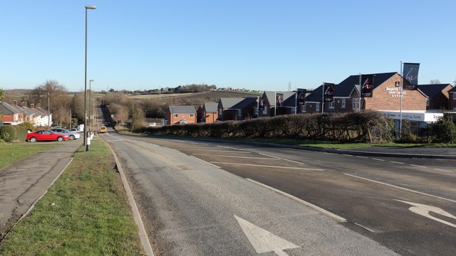
Image: © Alan Walker Taken: 7 Feb 2018
A walk around Grassmoor Image : Previous - (10 of 51) - Next : Image Looking in a north-easterly direction the photograph shows a new housing development on Birkin Lane. Ahead, the Lane rises to cross a bridge over the Five Pits Trail https://www.derbyshire.gov.uk/images/5%20Pits%20lft%20Jan%202014%20web_tcm44-216030.pdf . Just beyond the vehicle driving down the lane, on the left, there is an access point to Grassmoor Country Park https://www.derbyshire.gov.uk/images/Grassmoor%20Country%20Park_tcm44-194014.pdf .
Images are licensed for reuse under creativecommons.org/licenses/by-sa/2.0
Image Location
Latitude
53.197343
Longitude
-1.388933