
IMAGES TAKEN NEAR TO
Enterprise Drive, CHESTERFIELD, S42 5BZ
Introduction
This page details the photographs taken nearby to Enterprise Drive, S42 5BZ by members of the Geograph project.
The Geograph project started in 2005 with the aim of publishing, organising and preserving representative images for every square kilometre of Great Britain, Ireland and the Isle of Man.

There are currently over 7.5m images from over14,400 individuals and you can help contribute to the project by visiting https://www.geograph.org.uk
Image Map
Images are licensed for reuse under creativecommons.org/licenses/by-sa/2.0
Notes
- Clicking on the map will re-center to the selected point.
- The higher the marker number, the further away the image location is from the centre of the postcode.
Image Listing (12 Images Found)
Images are licensed for reuse under creativecommons.org/licenses/by-sa/2.0
Image
Details
Distance
1

At Williamthorpe Nature Reserve
On the Five Pits Trail
Image: © Neil Theasby
Taken: 3 Mar 2014
0.11 miles
2

The Five Pits Trail Williamthorpe loop
Walking the Five Pits Trail loop around Holmewood and Williamthorpe
Image : Previous – (11 of 21) - Next : Image
This south-westerly facing photograph is of the Five Pits Trail and is looking in the direction of Wolfie Pond from which a number of routes are possible, including, as the signage suggests the trail to Grassmoor.
At this point the trail is following the route of the Great Central Railway's Williamthorpe Colliery Branch line.
- - -
The Williamthorpe Colliery was serviced by one branch line that was operated by two different railway companies. An OS map surveyed in 1914 and published in 1921 shows that this section of the line was operated by the Great Central Railway. However, some 250m ahead the line passed under Chesterfield Road at which point ownership changed to the Midland Railway. Continuing westward the Midland Railway's Williamthorpe Colliery Branch line had a junction with its Pilsley Extension line in an area now known as Wolfie Pond.
Image: © Alan Walker
Taken: 31 Oct 2017
0.11 miles
3

Holmewood Industrial Park.
The Bryan Donkin building is just one of many on the site of an old colliery.
Image: © Roger Temple
Taken: 13 Oct 2006
0.11 miles
4
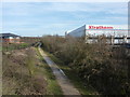
Well insulated
Factory in an industrial park at Holmewood, near Chesterfield. The track below is the Five Pits Trail.
The Five Pits Trail is on the line of former railway tracks,approximately 5.5-mile long,linking Grassmoor to Tibshelf. The Trail can be extended to 7.5 miles (12.1 km) by continuing along the route to Williamthorpe Ponds and Holmewood. Derbyshire County Council created the Five Pits Trail in 1989, following the route of the former Great Central Railway which served the five main coal mines of Grassmoor, Williamthorpe, Holmewood, Pilsley and Tibshelf.
Image: © Peter Barr
Taken: 24 Feb 2011
0.16 miles
5

Warehouse by a nature reserve
One of several large warehouses and other industrial or business premises at Holmewood, by the Willaimthorpe Ponds nature reserve developed on the site of a former colliery.
Image: © Andrew Hill
Taken: 12 Mar 2011
0.17 miles
6
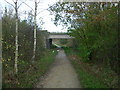
The Five Pits Trail near Holmewood
Bridge carrying the B6039 Holmewood to Temple Normanton road over the Five Pits Trail.
Image: © Gordon Elliott
Taken: 7 Nov 2009
0.17 miles
7

Signs and flag by Chesterfield Road
Drawing attention to the availability of poultry for sale. The board says "Pullets - POL". "POL" apparently stands for "point of lay". The flag certainly works in attracting notice.
Image: © Andrew Hill
Taken: 20 May 2011
0.18 miles
8

Houses by Chesterfield road
Traditional semi-detached houses by the B6039 Chesterfield Road in Holmewood.
Image: © Andrew Hill
Taken: 20 May 2011
0.20 miles
9

The Five Pits Trail
Just a hint of industry on the right to remind of what was once a dirty colliery environment. Cleaner industry, and open green space.
Image: © Chris Morgan
Taken: 29 Apr 2015
0.21 miles
10
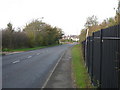
Approaching Temple Normanton
The B6039 approaching Temple Normanton from Holmewood
Image: © Gordon Elliott
Taken: 7 Nov 2009
0.23 miles