IMAGES TAKEN NEAR TO
Hulford Drive, CHESTERFIELD, S41 9SG
Introduction
This page details the photographs taken nearby to Hulford Drive, S41 9SG by members of the Geograph project.
The Geograph project started in 2005 with the aim of publishing, organising and preserving representative images for every square kilometre of Great Britain, Ireland and the Isle of Man.

There are currently over 7.5m images from over14,400 individuals and you can help contribute to the project by visiting https://www.geograph.org.uk
Image Map
Images are licensed for reuse under creativecommons.org/licenses/by-sa/2.0
Notes
- Clicking on the map will re-center to the selected point.
- The higher the marker number, the further away the image location is from the centre of the postcode.
Image Listing (13 Images Found)
Images are licensed for reuse under creativecommons.org/licenses/by-sa/2.0
Image
Details
Distance
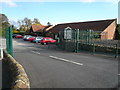
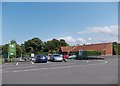
1
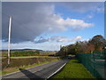
Dunston Road (B6050)
View towards Sheepbridge from car park entrance to Dunston Hall Garden Centre.
Image: © Alan Heardman
Taken: 29 Oct 2007
0.10 miles
2
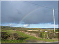
Dunston Road (B6050)
Looking across open countryside, with a clear view of a rainbow.
Image: © Alan Heardman
Taken: 29 Oct 2007
0.13 miles
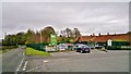
9
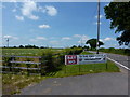
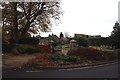
Dunston Road, Chesterfield
An incinerator is proposed on this semi-rural road, and a protest is being organised by local residents.
Image: © Peter Barr
Taken: 28 Jun 2010
0.20 miles
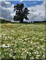
10
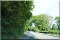
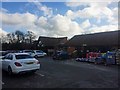
Near Dunstan Hall
A quiet road as we head towards Chatsworth.
Image: © Malcolm Neal
Taken: 5 Jun 2019
0.20 miles